Cof Cymru: National Historic Assets of Wales · Wales
Plas Gwyn
Beddgelert, Gwynedd, Wales
A Grade II listed building in Beddgelert, Caernarfon, Gwynedd, designated on 14 December 1961.
The record
- Designation
- Listed building, Grade II
- Broad class
- Domestic
- Date of designation
- 14 December 1961
- Locality
- Beddgelert
- Town
- Caernarfon
- Community
- Beddgelert
- Unitary authority
- Gwynedd
- Country
- Wales
- Coordinates
- 53.01207, -4.10294
- Cadw reference
- 3716
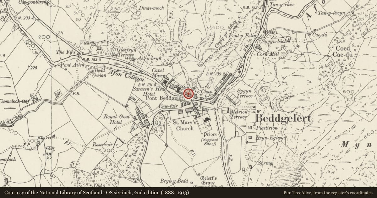
Slide toward Today to fade the historical sheet and see the modern map underneath.
David Rumsey Map Collection, Stanford LibrariesDavid Rumsey Map Collection, Stanford LibrariesDavid Rumsey Map Collection, Stanford LibrariesLlyfrgell Genedlaethol Cymru – The National Library of WalesDavid Rumsey Map Collection, Stanford Libraries
5 historical maps cover this location, the earliest the 1795 map "To Sir Watkin Williams-Wynn Bart ... the map of the six counties of North Wales is most humbly inscribed by his obedient humble servant" (Llyfrgell Genedlaethol Cymru – The National Library of Wales).
Historical maps covering this location
- 1795 · To Sir Watkin Williams-Wynn Bart ... the map of the six counties of North Wales is most… (Llyfrgell Genedlaethol Cymru – The National Library of Wales)
- 1883 · Watershed map England, Wales 3. (David Rumsey Map Collection, Stanford Libraries)
- 1896 · Sheet 7. Ordnance Survey of England and Wales. (David Rumsey Map Collection, Stanford Libraries)
- 1899 · 119 Snowdon (Hills) (David Rumsey Map Collection, Stanford Libraries)
- 1901 · Sheet 9 and 10. (David Rumsey Map Collection, Stanford Libraries)
Cadw's description
Location
Prominently located on the streetline in the centre of the village.
History
Built c1830 as part of a speculative development of the village on this side of the river by the Sygun estate on its Perthi Farm property. This development, to which the earliest of the C19 buildings in the village belong, was intended to serve the increasing numbers of tourists who were coming to Snowdonia in the second quarter of the century.
Exterior
Second-quarter C19 gabled house of two storeys plus attic, raised up above a basement. Of roughly-dressed and coursed stone construction with slate roof and plain chimneys; simple wavy bargeboards and deep verges. The entrance is to the R of the raised ground floor via a modern part-glazed porch, extruded in the angle between it and the advanced Colwyn Guest House, adjoining; accessed via a flight of railed, painted steps. Original 12-pane unhorned sash windows, those to the attic floor smaller; those to the L on the ground and first floors have modern external boarded shutters.
Interior
The interior was not inspected at the time of survey.
Reason for designation
Listed for its special interest as an ambitiously-conceived village house retaining much original character, within an unusual speculative development for the early tourist market.
Group value with other items in the main street in Beddgelert.
Nearby in the register
- Colwyn Guest HouseDomesticunder 1 mi
- Plas ColwynDomesticunder 1 mi
- Waterloo House (Beddgelert Antiques and Tea Rooms)Domesticunder 1 mi
- Prince Llewelyn HotelCommercialunder 1 mi
Other entries of the same register within about three miles of this one, by straight line.