Cof Cymru: National Historic Assets of Wales · Wales
Cambrian House
Mold, Flintshire, Wales
A Grade II listed building in Mold, Flintshire, designated on 30 March 1987.
The record
- Designation
- Listed building, Grade II
- Broad class
- Domestic
- Date of designation
- 30 March 1987
- Community
- Mold
- Unitary authority
- Flintshire
- Country
- Wales
- Coordinates
- 53.16773, -3.14289
- Cadw reference
- 366
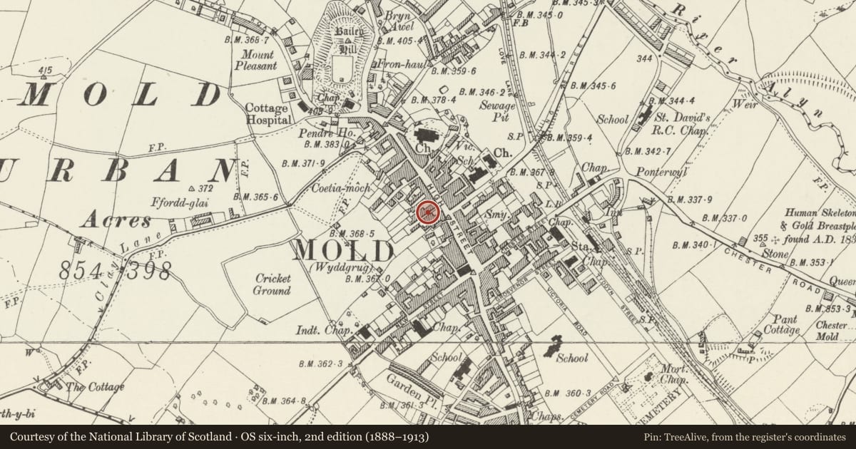
Slide toward Today to fade the historical sheet and see the modern map underneath.
David Rumsey Map Collection, Stanford LibrariesDavid Rumsey Map Collection, Stanford LibrariesDavid Rumsey Map Collection, Stanford LibrariesDavid Rumsey Map Collection, Stanford LibrariesLlyfrgell Genedlaethol Cymru – The National Library of Wales
5 historical maps cover this location, the earliest the 1795 map "To Sir Watkin Williams-Wynn Bart ... the map of the six counties of North Wales is most humbly inscribed by his obedient humble servant" (Llyfrgell Genedlaethol Cymru – The National Library of Wales).
Historical maps covering this location
- 1795 · To Sir Watkin Williams-Wynn Bart ... the map of the six counties of North Wales is most… (Llyfrgell Genedlaethol Cymru – The National Library of Wales)
- 1883 · Watershed map England, Wales 3. (David Rumsey Map Collection, Stanford Libraries)
- 1898 · 108 Flint (Hills) (David Rumsey Map Collection, Stanford Libraries)
- 1898 · 108 Flint (Outline) (David Rumsey Map Collection, Stanford Libraries)
- 1901 · Sheet 9 and 10. (David Rumsey Map Collection, Stanford Libraries)
Cadw's description
Location
On the street line adjoining Earl Chambers and near the corner with the High Street.
History
1910 by F A Roberts of Mold. Edwardian Baroque.
Exterior
2 storey, 7 bay, English bond brick on vermiculated stone plinth. Channelled freestone ground floor. Pedimented advanced end bays, channelled end pillasters. Pulvinated frieze, bracketed eaves cornice. Steep pitched slate roof with raking gable parapet, tall panelled stacks with bracketed cornices.
12 pane sashes to 1st floor with keystoned gauged brick voussoirs and sill aprons to centre bays; 8 pane sashes to 1st floor with keystoned gauged brick voussoirs and sills to end bays. Vermiculated keystones and aprons to ground floor round arched openings. Mullion and transom windows, glazing bars removed from lower lights. Round arched doorway with console keystone in right advanced bay, Iron gates flanked by small rectangular windows.
Interior
Interior has stair with good contemporary ironwork. Contemporaneous 2 storey, 1 window brick building with hipped roof and panelled stack adjoins to right.
Reason for designation
Group value.
Nearby in the register
- Earl Buildings including Town & Country & C.WilcoxCommercialunder 1 mi
- Thomsons Wines & SpirtsCommercialunder 1 mi
- H.I. Jones, ChemistCommercialunder 1 mi
- Earl Chambers (Chester Chronicle Building)Commercialunder 1 mi
Other entries of the same register within about three miles of this one, by straight line.