Cof Cymru: National Historic Assets of Wales · Wales
Telephone Call-box immediately S of the Road Junction at Maenan School (tel no: 01492 660279)
Llanddoged and Maenan, Conwy, Wales
A Grade II listed building in Maenan, Llanddoged and Maenan, Conwy, designated on 5 November 1990.
The record
- Designation
- Listed building, Grade II
- Broad class
- Communications
- Date of designation
- 5 November 1990
- Locality
- Maenan
- Community
- Llanddoged and Maenan
- Unitary authority
- Conwy
- Country
- Wales
- Coordinates
- 53.18182, -3.80495
- Cadw reference
- 3646
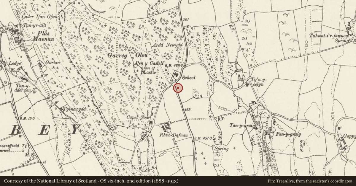
Slide toward Today to fade the historical sheet and see the modern map underneath.
David Rumsey Map Collection, Stanford LibrariesDavid Rumsey Map Collection, Stanford LibrariesDavid Rumsey Map Collection, Stanford LibrariesLlyfrgell Genedlaethol Cymru – The National Library of WalesDavid Rumsey Map Collection, Stanford Libraries
5 historical maps cover this location, the earliest the 1795 map "To Sir Watkin Williams-Wynn Bart ... the map of the six counties of North Wales is most humbly inscribed by his obedient humble servant" (Llyfrgell Genedlaethol Cymru – The National Library of Wales).
Historical maps covering this location
- 1795 · To Sir Watkin Williams-Wynn Bart ... the map of the six counties of North Wales is most… (Llyfrgell Genedlaethol Cymru – The National Library of Wales)
- 1883 · Watershed map England, Wales 3. (David Rumsey Map Collection, Stanford Libraries)
- 1899 · 106 Bangor (Outline) (David Rumsey Map Collection, Stanford Libraries)
- 1899 · 106 Bangor (Hills) (David Rumsey Map Collection, Stanford Libraries)
- 1901 · Sheet 9 and 10. (David Rumsey Map Collection, Stanford Libraries)
Cadw's description
Location
In a remarkable scenic location: set into a grass verge with its back to a rubble boundary wall; 'E II R' letter-box on pole adjoining to L.
History
K6-type square, red telephone kiosk; of cast-iron construction to the standard design of Giles Gilbert Scott, architect of London. Design introduced by the GPO in 1936; this example dates from the reign of Queen Elizabeth II. Foundry plate not visible.
Exterior
Domed roof with 4 lunettes containing embossed crowns over red lettered opals and ventilation slits. Raised surrounds to sides and door with marginal bars to horizontal glazing. Blank rear, moulded plinth.
Reason for designation
Included for its exceptional landscape setting in the Conwy valley.
Nearby in the register
- Caer Oleu CampHillfortunder 1 mi
- Site of Aberconwy Abbey, MaenanAbbeyunder 1 mi
- Former Carthouse Range at Maes-yr-Hendre CottageAgriculture and Subsistenceunder 1 mi
- Former Brewhouse at Maes-yr-Hendre CottageAgriculture and Subsistenceunder 1 mi
Other entries of the same register within about three miles of this one, by straight line.