Cof Cymru: National Historic Assets of Wales · Wales
Former Carthouse Range at Maes-yr-Hendre Cottage
Llanddoged and Maenan, Conwy, Wales
A Grade II listed building in Maenan, Llanddoged and Maenan, Conwy, designated on 17 February 1997.
The record
- Designation
- Listed building, Grade II
- Broad class
- Agriculture and Subsistence
- Date of designation
- 17 February 1997
- Locality
- Maenan
- Community
- Llanddoged and Maenan
- Unitary authority
- Conwy
- Country
- Wales
- Coordinates
- 53.19035, -3.80929
- Cadw reference
- 18236
Slide toward Today to fade the historical sheet and see the modern map underneath.
David Rumsey Map Collection, Stanford LibrariesDavid Rumsey Map Collection, Stanford LibrariesDavid Rumsey Map Collection, Stanford LibrariesLlyfrgell Genedlaethol Cymru – The National Library of WalesDavid Rumsey Map Collection, Stanford Libraries
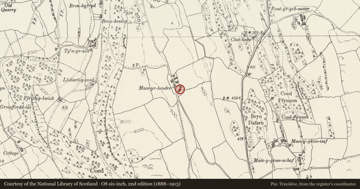
5 historical maps cover this location, the earliest the 1795 map "To Sir Watkin Williams-Wynn Bart ... the map of the six counties of North Wales is most humbly inscribed by his obedient humble servant" (Llyfrgell Genedlaethol Cymru – The National Library of Wales).
Historical maps covering this location
- 1795 · To Sir Watkin Williams-Wynn Bart ... the map of the six counties of North Wales is most… (Llyfrgell Genedlaethol Cymru – The National Library of Wales)
- 1883 · Watershed map England, Wales 3. (David Rumsey Map Collection, Stanford Libraries)
- 1899 · 106 Bangor (Outline) (David Rumsey Map Collection, Stanford Libraries)
- 1899 · 106 Bangor (Hills) (David Rumsey Map Collection, Stanford Libraries)
- 1901 · Sheet 9 and 10. (David Rumsey Map Collection, Stanford Libraries)
Cadw's description
Location
Located immediately to the SW of Maes-yr-Hendre Cottage, and closing a farmyard area to the SE.
Exterior
Early C19 carthouse block with adjoining, later C19 cart sheds of rubble construction with slate roofs. The carthouse section (to the R) is a rectangular storeyed block with wide, depressed-arched cart opening at R; slate ashlar voussoirs below narrow arch ring. To the L of this is a small window with modern glazing and beyond, a plain entrance with boarded door. 2 further, plain windows to the upper floor, under the eaves. External slate stepped access to upper boarded entrance at rear. The adjoining cartshed section (to the L) is single storey and is stepped down. Plain central cart entrance with, originally, a further cart entrance to the R and a stable opening to the L; these are now blocked.
Reason for designation
Included for group value with Maes-yr-Hendre Cottage and Former Brewhouse at Maes-yr-Hendre Cottage.
Nearby in the register
- Former Brewhouse at Maes-yr-Hendre CottageAgriculture and Subsistenceunder 1 mi
- Maes-yr-Hendre CottageDomesticunder 1 mi
- Maes-yr-Hendre FarmhouseDomesticunder 1 mi
- Caer Oleu CampHillfortunder 1 mi
Other entries of the same register within about three miles of this one, by straight line.