Cof Cymru: National Historic Assets of Wales · Wales
Dovecote at Gloddaeth Hall, including attached single-storey blocks
Llandudno, Conwy, Wales
A Grade II* listed building in Gloddaeth Hall, Llandudno, Conwy, designated on 16 March 1976.
The record
- Designation
- Listed building, Grade II*
- Broad class
- Domestic
- Date of designation
- 16 March 1976
- Locality
- Gloddaeth Hall
- Town
- Llandudno
- Community
- Llandudno
- Unitary authority
- Conwy
- Country
- Wales
- Coordinates
- 53.30975, -3.79713
- Cadw reference
- 3415
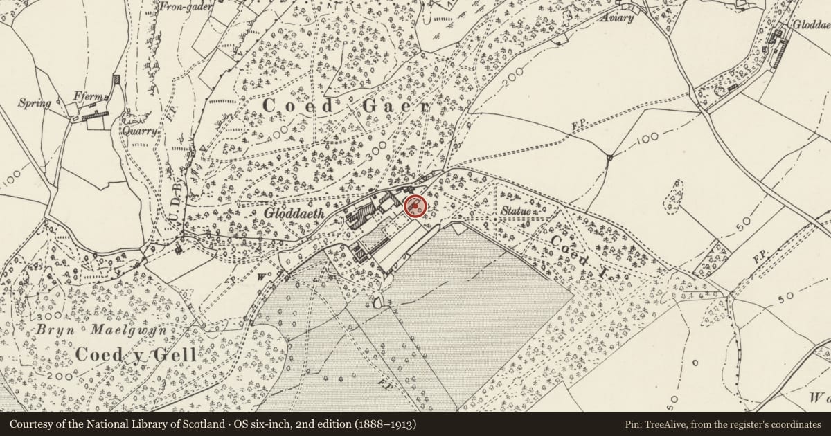
Slide toward Today to fade the historical sheet and see the modern map underneath.
David Rumsey Map Collection, Stanford LibrariesDavid Rumsey Map Collection, Stanford LibrariesDavid Rumsey Map Collection, Stanford LibrariesLlyfrgell Genedlaethol Cymru – The National Library of WalesNational Library of Scotland
5 historical maps cover this location, the earliest the 1795 map "To Sir Watkin Williams-Wynn Bart ... the map of the six counties of North Wales is most humbly inscribed by his obedient humble servant" (Llyfrgell Genedlaethol Cymru – The National Library of Wales).
Historical maps covering this location
- 1795 · To Sir Watkin Williams-Wynn Bart ... the map of the six counties of North Wales is most… (Llyfrgell Genedlaethol Cymru – The National Library of Wales)
- 1883 · Watershed map England, Wales 3. (David Rumsey Map Collection, Stanford Libraries)
- 1899 · 94 Beaumaris (Hills) (David Rumsey Map Collection, Stanford Libraries)
- 1901 · Sheet 9 and 10. (David Rumsey Map Collection, Stanford Libraries)
- 1930 · OS Popular Edition 1919-1947 (National Library of Scotland)
Cadw's description
Location
About 100m E of Hall, to S of former stables.
History
C17 dovecote, attached blocks to N & S probably C19, and were service buildings of stable yard.
Exterior
Dovecote in form of square tower of stone rubble with large quoins with four crow-stepped gables, each gable pierced by a square opening. Slate roof with later square sided cupola with bargeboards and weathervane. Sill course below gables. Dovecote in upper part of building, accessible externally; store room below with doorway and window on N side. To NE and SW are long single-storey blocks, with rubble walling. Block to SW has slate roof, and camber-headed brick openings.
Reason for designation
Graded II* as well-preserved C17 dovecote. Group Value with Gloddaeth Hall.
Nearby in the register
- Former Stable Block at Gloddaeth HallEducationunder 1 mi
- Garden wall, including stone doorway at E end of garden in front of Gloddaeth Hall.Domesticunder 1 mi
- Matron's Cottage at Gloddaeth HallDomesticunder 1 mi
- Wall on NE side of former Kitchen Garden at Gloddaeth HallDomesticunder 1 mi
Other entries of the same register within about three miles of this one, by straight line.