Cof Cymru: National Historic Assets of Wales · Wales
Gorphwysfa
Conwy, Conwy, Wales
A Grade II listed building in Tywyn, Conwy, designated on 8 October 1981.
The record
- Designation
- Listed building, Grade II
- Broad class
- Domestic
- Date of designation
- 8 October 1981
- Locality
- Tywyn
- Community
- Conwy
- Unitary authority
- Conwy
- Country
- Wales
- Coordinates
- 53.29049, -3.82219
- Cadw reference
- 3330
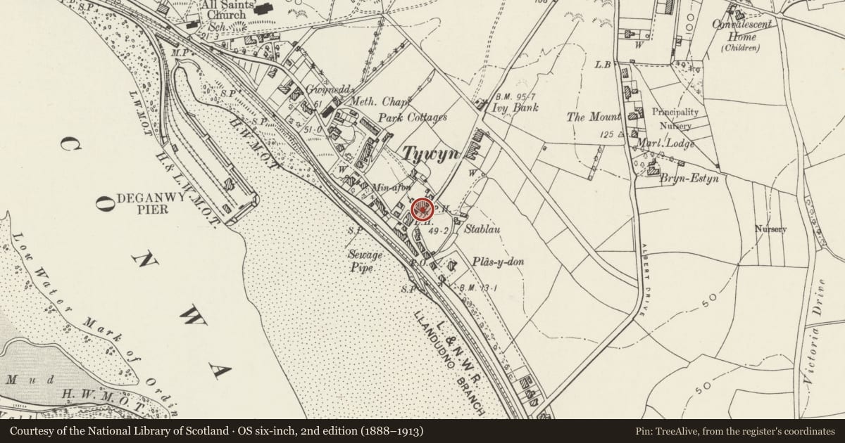
Slide toward Today to fade the historical sheet and see the modern map underneath.
David Rumsey Map Collection, Stanford LibrariesDavid Rumsey Map Collection, Stanford LibrariesDavid Rumsey Map Collection, Stanford LibrariesLlyfrgell Genedlaethol Cymru – The National Library of WalesDavid Rumsey Map Collection, Stanford Libraries
5 historical maps cover this location, the earliest the 1795 map "To Sir Watkin Williams-Wynn Bart ... the map of the six counties of North Wales is most humbly inscribed by his obedient humble servant" (Llyfrgell Genedlaethol Cymru – The National Library of Wales).
Historical maps covering this location
- 1795 · To Sir Watkin Williams-Wynn Bart ... the map of the six counties of North Wales is most… (Llyfrgell Genedlaethol Cymru – The National Library of Wales)
- 1830 · V.3:11-15:XV. Britisches Reich. A. Kon: England. b. Frstenthum Wales: Shire: 37-40 (David Rumsey Map Collection, Stanford Libraries)
- 1883 · Watershed map England, Wales 3. (David Rumsey Map Collection, Stanford Libraries)
- 1899 · 94 Beaumaris (Hills) (David Rumsey Map Collection, Stanford Libraries)
- 1901 · Sheet 9 and 10. (David Rumsey Map Collection, Stanford Libraries)
Cadw's description
Location
At R angles to the road approximately 80m NE of the junction with Glan-y-Mor Road (A546).
History
A mid C19 house shown on the 1890 Ordnance Survey.
Exterior
A late-Georgian 2-storey house of 1+3 bays, of pebble-dashed walls, slate roof and stack to the R. The 3-bay main house has an advanced gabled bay slightly offset L of centre. It has a gabled 1-storey porch with half-glazed door on the R side, 12-pane hornless sash window to the front and small-pane window to the L side. Inside is a modern boarded door under an original overlight. Windows in the main range are 12-pane hornless sashes. The additional bay on the L side, possibly once incorporating a granary in the upper storey, has a C20 window in the lower storey.
Attached to the rear is a lower 2-storey house (Lavender Cottage, formerly Farmers Arms) at R angles.
Interior
Not inspected.
Reason for designation
Listed for its special architectural interest as a C19 Georgian-style house retaining early character.
Nearby in the register
- MinafonNo class recordedunder 1 mi
- Park LodgeNo class recordedunder 1 mi
- Church of All SaintsReligious, Ritual and Funeraryunder 1 mi
- VeneziaCommercialunder 1 mi
Other entries of the same register within about three miles of this one, by straight line.