Cof Cymru: National Historic Assets of Wales · Wales
Venezia
Conwy, Conwy, Wales
A Grade II listed building in Deganwy, Conwy, designated on 8 October 1981.
The record
- Designation
- Listed building, Grade II
- Broad class
- Commercial
- Date of designation
- 8 October 1981
- Locality
- Deganwy
- Community
- Conwy
- Unitary authority
- Conwy
- Country
- Wales
- Coordinates
- 53.29483, -3.83268
- Cadw reference
- 3357
Slide toward Today to fade the historical sheet and see the modern map underneath.
David Rumsey Map Collection, Stanford LibrariesDavid Rumsey Map Collection, Stanford LibrariesDavid Rumsey Map Collection, Stanford LibrariesLlyfrgell Genedlaethol Cymru – The National Library of WalesDavid Rumsey Map Collection, Stanford Libraries
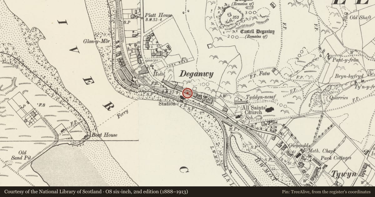
5 historical maps cover this location, the earliest the 1795 map "To Sir Watkin Williams-Wynn Bart ... the map of the six counties of North Wales is most humbly inscribed by his obedient humble servant" (Llyfrgell Genedlaethol Cymru – The National Library of Wales).
Historical maps covering this location
- 1795 · To Sir Watkin Williams-Wynn Bart ... the map of the six counties of North Wales is most… (Llyfrgell Genedlaethol Cymru – The National Library of Wales)
- 1830 · V.3:11-15:XV. Britisches Reich. A. Kon: England. b. Frstenthum Wales: Shire: 37-40 (David Rumsey Map Collection, Stanford Libraries)
- 1883 · Watershed map England, Wales 3. (David Rumsey Map Collection, Stanford Libraries)
- 1899 · 94 Beaumaris (Hills) (David Rumsey Map Collection, Stanford Libraries)
- 1901 · Sheet 9 and 10. (David Rumsey Map Collection, Stanford Libraries)
Cadw's description
Location
One of a pair of commercial buildings fronting the street opposite Deganwy Station.
History
Late C19 shops with houses shown on the 1889 Ordnance Survey, to which a cast-iron veranda was subsequently added. The veranda is shown in an early C20 photograph, when the houses still had sash windows.
Exterior
A 2½-storey shop and house, of rendered front with slate roof (and one of a reflected pair with No 145). The shop front is asymmetrical. It has a larger window to the L, with transom, and narrower plain window to the R, both with cast-iron grille above. The recessed entrance, with diaper floor, has a half-glazed door under deep cast-iron grille. The 1st-floor oriel window to the L and smaller window to the R are replacements in original openings. The flat roof dormer is a later addition.
A cast iron veranda of 6 bays spans Nos 131 (2 bays), 137 (3 bays) and 143 (1 bay). It has round posts, the lower parts fluted and with Corinthian capitals, foliage brackets incorporating rosettes, to a foliage openwork fascia and brattishing with corner finials. In the 3rd bay the fascia is in the form of an iron grille with '[D]EGANWY' in raised letters, above which is a crest and a panel with 'J E JONES'. The 6th bay has a similar crest but its original name panel has been removed.
Reason for designation
Listed as late C19 commercial buidlings notable for the fine late C19 cast-iron veranda.
Nearby in the register
- Sunnyside and Cafe T'airNo class recordedunder 1 mi
- Gorse Bank and TownstyleNo class recordedunder 1 mi
- Deganwy Castle HotelCommercialunder 1 mi
- BrackenriggNo class recordedunder 1 mi
Other entries of the same register within about three miles of this one, by straight line.