Cof Cymru: National Historic Assets of Wales · Wales
1 Erskine Terrace
Conwy, Conwy, Wales
A Grade II listed building in Walled town, Conwy, designated on 8 October 1981.
The record
- Designation
- Listed building, Grade II
- Broad class
- Domestic
- Date of designation
- 8 October 1981
- Locality
- Walled town
- Town
- Conwy
- Community
- Conwy
- Unitary authority
- Conwy
- Country
- Wales
- Coordinates
- 53.28136, -3.83079
- Cadw reference
- 3284
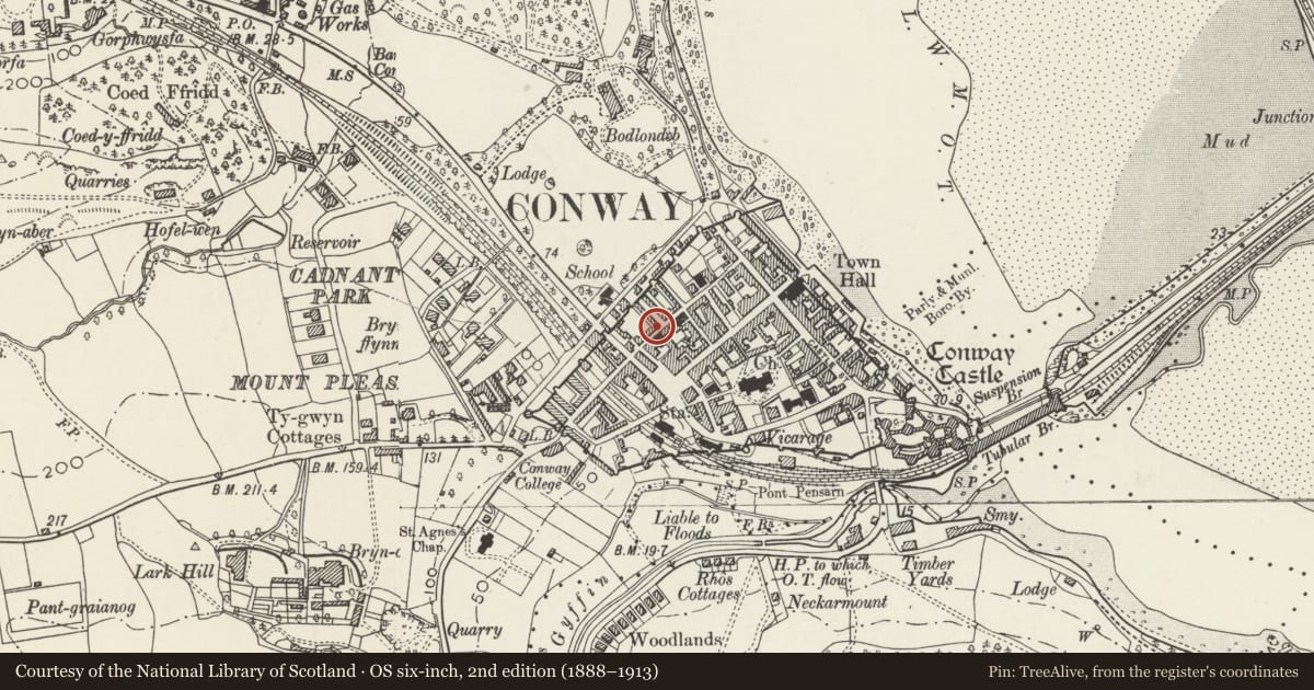
Slide toward Today to fade the historical sheet and see the modern map underneath.
David Rumsey Map Collection, Stanford LibrariesDavid Rumsey Map Collection, Stanford LibrariesDavid Rumsey Map Collection, Stanford LibrariesLlyfrgell Genedlaethol Cymru – The National Library of WalesDavid Rumsey Map Collection, Stanford Libraries
5 historical maps cover this location, the earliest the 1795 map "To Sir Watkin Williams-Wynn Bart ... the map of the six counties of North Wales is most humbly inscribed by his obedient humble servant" (Llyfrgell Genedlaethol Cymru – The National Library of Wales).
Historical maps covering this location
- 1795 · To Sir Watkin Williams-Wynn Bart ... the map of the six counties of North Wales is most… (Llyfrgell Genedlaethol Cymru – The National Library of Wales)
- 1830 · V.3:11-15:XV. Britisches Reich. A. Kon: England. b. Frstenthum Wales: Shire: 37-40 (David Rumsey Map Collection, Stanford Libraries)
- 1883 · Watershed map England, Wales 3. (David Rumsey Map Collection, Stanford Libraries)
- 1899 · 94 Beaumaris (Hills) (David Rumsey Map Collection, Stanford Libraries)
- 1901 · Sheet 9 and 10. (David Rumsey Map Collection, Stanford Libraries)
Cadw's description
Location
On the corner of Chapel Street.
History
One of a terrace of mid C19 houses first shown on the 1889 Ordnance Survey. Additions were made to the rear in the 1960s.
Exterior
Belongs to a group of 1-15 Erskine Terrace.
A terrace of 2-storey single-fronted houses of rubble stone, slate roof and mainly shared stone stacks, but pebble-dashed stack between Nos 1 and 3 and to the R end of No 15. Windows have segmental stone heads and are beneath gables in the upper-storey. No 1 is on the corner of Chapel Street. It has brick steps up to a half-glazed replacement panel door on the L and 2-pane horned sash windows on the R. Its gable end is pebble-dashed and has a horned sash window in the upper storey.
Nos 3-13 are in reflected pairs with the entrances on the inner sides. No 3 has a replacement half-glazed door, ground-floor 12-pane and 1st-floor 9-pane hornless sash windows. No 5 has a replacement door, 2-pane horned sash window in the ground floor and replacement top-hung casement above. The terrace is stepped up between Nos 5 and 7. Nos 7 and 9 both have replacement doors and replacement top-hung casement windows. Nos 11-13 both have replacement doors, 2-pane sash windows in the ground floor and replacement 1st-floor top-hung casements. No 15 is slightly higher than the remainder of the row but the roof is pitched at the same angle. It has a boarded door on the L, and 12-pane and 9-pane hornless sash windows. The R gable end is pebble-dashed, where an earlier attached building has been taken down.
To the rear is No 1 has a wing with 2-pane sashes in each storey facing Chapel Street. Nos 3-13 have replacement windows and the 1960s paired 2-storey flat roof extensions with higher eaves line than the main range.
Reason for designation
Listed for its special interest as one of a terrace of small simple town houses retaining definite C19 character, for its contribution to the architectural integrity of Erskine Terrace and overall historical townscape.
Nearby in the register
- Carreg LwydNo class recordedunder 1 mi
- 25 Chapel StreetDomesticunder 1 mi
- 26 Chapel StreetDomesticunder 1 mi
- 5 Erskine TerraceNo class recordedunder 1 mi
Other entries of the same register within about three miles of this one, by straight line.