Cof Cymru: National Historic Assets of Wales · Wales
House and Celtic Shops Ltd
Conwy, Conwy, Wales
A Grade II listed building in Walled town, Conwy, designated on 8 October 1981.
The record
- Designation
- Listed building, Grade II
- Broad class
- Commercial
- Date of designation
- 8 October 1981
- Locality
- Walled town
- Town
- Conwy
- Community
- Conwy
- Unitary authority
- Conwy
- Country
- Wales
- Coordinates
- 53.28153, -3.82805
- Cadw reference
- 3255
Slide toward Today to fade the historical sheet and see the modern map underneath.
David Rumsey Map Collection, Stanford LibrariesDavid Rumsey Map Collection, Stanford LibrariesDavid Rumsey Map Collection, Stanford LibrariesLlyfrgell Genedlaethol Cymru – The National Library of WalesDavid Rumsey Map Collection, Stanford Libraries
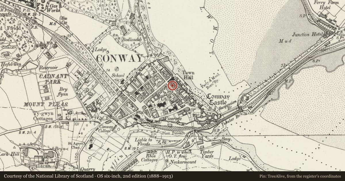
5 historical maps cover this location, the earliest the 1795 map "To Sir Watkin Williams-Wynn Bart ... the map of the six counties of North Wales is most humbly inscribed by his obedient humble servant" (Llyfrgell Genedlaethol Cymru – The National Library of Wales).
Historical maps covering this location
- 1795 · To Sir Watkin Williams-Wynn Bart ... the map of the six counties of North Wales is most… (Llyfrgell Genedlaethol Cymru – The National Library of Wales)
- 1830 · V.3:11-15:XV. Britisches Reich. A. Kon: England. b. Frstenthum Wales: Shire: 37-40 (David Rumsey Map Collection, Stanford Libraries)
- 1883 · Watershed map England, Wales 3. (David Rumsey Map Collection, Stanford Libraries)
- 1899 · 94 Beaumaris (Hills) (David Rumsey Map Collection, Stanford Libraries)
- 1901 · Sheet 9 and 10. (David Rumsey Map Collection, Stanford Libraries)
Cadw's description
Location
One of a pair of shops with accommodation above fronting the street.
History
Nos 7-9 Castle Street were built in the 2nd half of the C19 and are shown on the 1889 Ordnance Survey. In the early C20 No 7 was Joseph Jones, shoe shop.
Exterior
Belongs to a group of 7-9 Castle Street.
A pair of mid C19 shops with houses above, in a range of 3 storeys grouped 2+3 bays, of whitened scribed roughcast, rusticated rock-faced quoins painted black, and slate roof on projecting dentil eaves. A whitened scribed roughcast stack is to the R, white roughcast stack L of centre, and grey roughcast stack to the L end. The lower storey has shop fronts. Above, the windows have similar black-painted keyed architraves, with cornices on consoles in the middle storey, and sill bands.
Modern 3-light shop window and double glazed door to the L. On the R side is a replacement glazed door to the house. The fascia is modern. The 1st bay has a double-height oriel window with small-pane glazing to 2-light casements (replacing original sashes). The 2nd bay has similar glazing to window slightly shorter than the sashes they replaced.
The rear is whitened render, with projecting lower 3-storey gabled bay offset to the L of centre. It has replacement windows and 2 large added gabled roof dormers.
Interior
Modernised.
Reason for designation
Listed for its special architectural interest as one of a pair of shops with accommodation above retaining definite C19 character, and for its group value within the historical townscape.
Nearby in the register
- Eagles Building (Fishermans Chip Shop and Carolina's Ice Cream)No class recordedunder 1 mi
- Conwy Outdoor shop and Anna's Tea RoomsNo class recordedunder 1 mi
- House, shop and hairdresser'sCommercialunder 1 mi
- House and Fruits & Shoots (No 6a) and Conwy Strollers (No 6)Commercialunder 1 mi
Other entries of the same register within about three miles of this one, by straight line.