Cof Cymru: National Historic Assets of Wales · Wales
House, shop and hairdresser's
Conwy, Conwy, Wales
A Grade II listed building in Walled town, Conwy, designated on 23 September 1950.
The record
- Designation
- Listed building, Grade II
- Broad class
- Commercial
- Date of designation
- 23 September 1950
- Locality
- Walled town
- Town
- Conwy
- Community
- Conwy
- Unitary authority
- Conwy
- Country
- Wales
- Coordinates
- 53.28163, -3.82822
- Cadw reference
- 3254
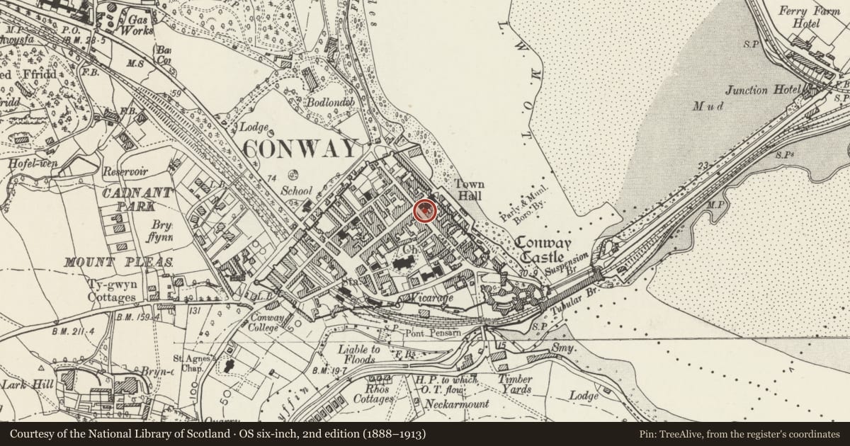
Slide toward Today to fade the historical sheet and see the modern map underneath.
David Rumsey Map Collection, Stanford LibrariesDavid Rumsey Map Collection, Stanford LibrariesDavid Rumsey Map Collection, Stanford LibrariesLlyfrgell Genedlaethol Cymru – The National Library of WalesDavid Rumsey Map Collection, Stanford Libraries
5 historical maps cover this location, the earliest the 1795 map "To Sir Watkin Williams-Wynn Bart ... the map of the six counties of North Wales is most humbly inscribed by his obedient humble servant" (Llyfrgell Genedlaethol Cymru – The National Library of Wales).
Historical maps covering this location
- 1795 · To Sir Watkin Williams-Wynn Bart ... the map of the six counties of North Wales is most… (Llyfrgell Genedlaethol Cymru – The National Library of Wales)
- 1830 · V.3:11-15:XV. Britisches Reich. A. Kon: England. b. Frstenthum Wales: Shire: 37-40 (David Rumsey Map Collection, Stanford Libraries)
- 1883 · Watershed map England, Wales 3. (David Rumsey Map Collection, Stanford Libraries)
- 1899 · 94 Beaumaris (Hills) (David Rumsey Map Collection, Stanford Libraries)
- 1901 · Sheet 9 and 10. (David Rumsey Map Collection, Stanford Libraries)
Cadw's description
Location
Fronting the street near the NW end of Castle Street.
History
An early C19 house, later converted to house and 2 shops, first shown on the 1889 Ordnance Survey.
Exterior
A 2-storey 2-window shop and house of rubble stone, slate roof and tall C20 brick end stacks. The original central entrance has a replacement glazed door under a canopy, to the R of which is a large shop window of 7x3 panes, under a fascia. A second shop front on the L side has a fielded-panel door under a narrow overlight, to the R of which is a small-pane shop window of 4x3 panes, all under a fascia. Below both shop windows are basement openings boarded up. In the upper storey are 16-pane hornless sash windows under segmental heads.
Interior
Modernised.
Reason for designation
Listed for its special architectural interest as an early C19 house, later converted for commercial use, retaining definite early character, and for its group value within the historical townscape.
Nearby in the register
- Eagles Building (Fishermans Chip Shop and Carolina's Ice Cream)No class recordedunder 1 mi
- Entrance range of Conwy Public LibraryEducationunder 1 mi
- House and Celtic Shops LtdCommercialunder 1 mi
- Aberconwy HouseDomesticunder 1 mi
Other entries of the same register within about three miles of this one, by straight line.