Cof Cymru: National Historic Assets of Wales · Wales
Plas Ucha Farmhouse
Nercwys, Flintshire, Wales
A Grade II listed building in Plas Ucha, Nercwys, Flintshire, designated on 6 November 1962.
The record
- Designation
- Listed building, Grade II
- Broad class
- Domestic
- Date of designation
- 6 November 1962
- Locality
- Plas Ucha
- Community
- Nercwys
- Unitary authority
- Flintshire
- Country
- Wales
- Coordinates
- 53.12484, -3.14811
- Cadw reference
- 315
Slide toward Today to fade the historical sheet and see the modern map underneath.
David Rumsey Map Collection, Stanford LibrariesDavid Rumsey Map Collection, Stanford LibrariesDavid Rumsey Map Collection, Stanford LibrariesDavid Rumsey Map Collection, Stanford LibrariesLlyfrgell Genedlaethol Cymru – The National Library of Wales
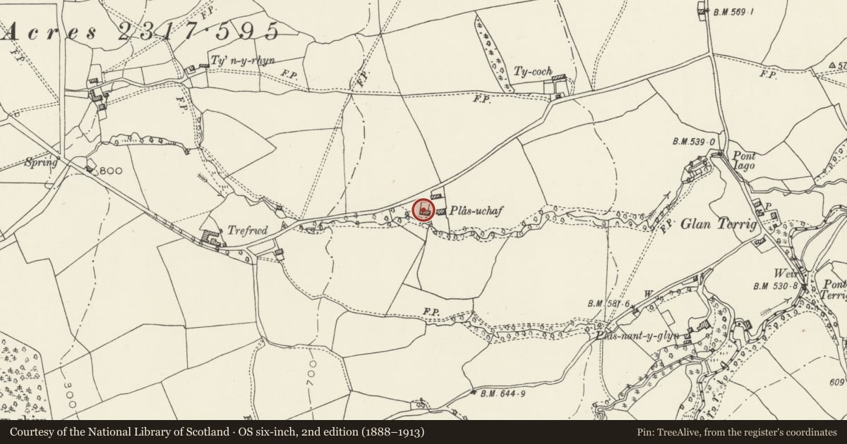
5 historical maps cover this location, the earliest the 1795 map "To Sir Watkin Williams-Wynn Bart ... the map of the six counties of North Wales is most humbly inscribed by his obedient humble servant" (Llyfrgell Genedlaethol Cymru – The National Library of Wales).
Historical maps covering this location
- 1795 · To Sir Watkin Williams-Wynn Bart ... the map of the six counties of North Wales is most… (Llyfrgell Genedlaethol Cymru – The National Library of Wales)
- 1883 · Watershed map England, Wales 3. (David Rumsey Map Collection, Stanford Libraries)
- 1898 · 108 Flint (Hills) (David Rumsey Map Collection, Stanford Libraries)
- 1898 · 108 Flint (Outline) (David Rumsey Map Collection, Stanford Libraries)
- 1901 · Sheet 9 and 10. (David Rumsey Map Collection, Stanford Libraries)
Cadw's description
Location
To the S of Nercwys village. Located on the S side of a lane leading off to the W at the lower end of Fordd Nercwys, and set back behind a dwarf-walled front garden.
Exterior
A 2-storey second-half C17 rubble-built farmhouse under a steeply-pitched slate roof with slightly oversailing eaves. The building has recently been heavily restored and all fenestration and entrances have been renewed in C17 style. Plain end chimneys. Near- symmetrical 5-bay facade with central Tudor-arched entrance with moulded and stopped jambs and returned moulded label. Modern boarded door. Wooden leaded cross-windows with stone cills and lintels, those to ground floor with labels also. To the L (W) a flush half-gable wing, the main roof hipped at their intersection. Smaller entrance as before to R with 2-light mullioned window to L. Labels as before. Above, a similar 3-light mullioned window. Modern single-storey extension to L of rear.
Interior
Heavily-moulded fireplace breastsummer to ground floor L room. Stair rising through 2 storeys with close string, turned balusters, moulded rail and stopped ovolo-moulded newels with finials.
Reason for designation
Hubbard, Clwyd, 406.
Nearby in the register
- Barn at Plas Ucha FarmAgriculture and Subsistenceunder 1 mi
- Adjoining Farm Buildings to east of Trefrwd FarmAgriculture and Subsistenceunder 1 mi
- Coach-House and Stable Block at Trefrwd FarmDomesticunder 1 mi
- Trefrwd FarmhouseDomesticunder 1 mi
Other entries of the same register within about three miles of this one, by straight line.