Cof Cymru: National Historic Assets of Wales · Wales
Barn at Plas Ucha Farm
Nercwys, Flintshire, Wales
A Grade II listed building in Plas Ucha, Nercwys, Flintshire, designated on 12 December 1994.
The record
- Designation
- Listed building, Grade II
- Broad class
- Agriculture and Subsistence
- Date of designation
- 12 December 1994
- Locality
- Plas Ucha
- Community
- Nercwys
- Unitary authority
- Flintshire
- Country
- Wales
- Coordinates
- 53.12484, -3.14766
- Cadw reference
- 15249
Slide toward Today to fade the historical sheet and see the modern map underneath.
David Rumsey Map Collection, Stanford LibrariesDavid Rumsey Map Collection, Stanford LibrariesDavid Rumsey Map Collection, Stanford LibrariesDavid Rumsey Map Collection, Stanford LibrariesLlyfrgell Genedlaethol Cymru – The National Library of Wales
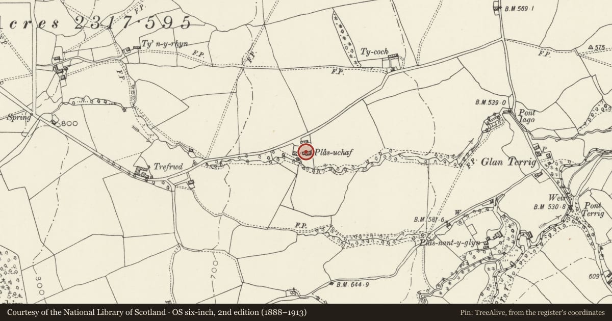
5 historical maps cover this location, the earliest the 1795 map "To Sir Watkin Williams-Wynn Bart ... the map of the six counties of North Wales is most humbly inscribed by his obedient humble servant" (Llyfrgell Genedlaethol Cymru – The National Library of Wales).
Historical maps covering this location
- 1795 · To Sir Watkin Williams-Wynn Bart ... the map of the six counties of North Wales is most… (Llyfrgell Genedlaethol Cymru – The National Library of Wales)
- 1883 · Watershed map England, Wales 3. (David Rumsey Map Collection, Stanford Libraries)
- 1898 · 108 Flint (Hills) (David Rumsey Map Collection, Stanford Libraries)
- 1898 · 108 Flint (Outline) (David Rumsey Map Collection, Stanford Libraries)
- 1901 · Sheet 9 and 10. (David Rumsey Map Collection, Stanford Libraries)
Cadw's description
Location
Immediately to the W of the farmhouse forming the S side of the farmyard.
Exterior
Probably late C17 5-bay gabled barn of rubble under a slate roof. Rubble gable parapets with plain kneelers. Wide cart entrance to the L with rough shaped timber lintel, now walled up. Then 3 modern 6-pane steel windows with exposed timber lintels relating to earlier entrances. Then a modern steel door and 2 further windows as before. 4 square unglazed window openings under the eaves, that to the L with boarded shutter. 2 exposed ventilation slits. Loading bay to W gable end with boarded door and a modern entrance below. To the rear, a modern lean-to, occupying the entire length of the range.
Reason for designation
Included for group value with Plas Ucha farmhouse.
Nearby in the register
- Plas Ucha FarmhouseDomesticunder 1 mi
- Adjoining Farm Buildings to east of Trefrwd FarmAgriculture and Subsistenceunder 1 mi
- Coach-House and Stable Block at Trefrwd FarmDomesticunder 1 mi
- Trefrwd FarmhouseDomesticunder 1 mi
Other entries of the same register within about three miles of this one, by straight line.