Cof Cymru: National Historic Assets of Wales · Wales
55 York Place
Stow Hill, Newport, Wales
A Grade II listed building in Stow Hill, Newport, designated on 2 May 1980.
The record
- Designation
- Listed building, Grade II
- Broad class
- Domestic
- Date of designation
- 2 May 1980
- Community
- Stow Hill
- Unitary authority
- Newport
- Country
- Wales
- Coordinates
- 51.58395, -3.00361
- Cadw reference
- 3049
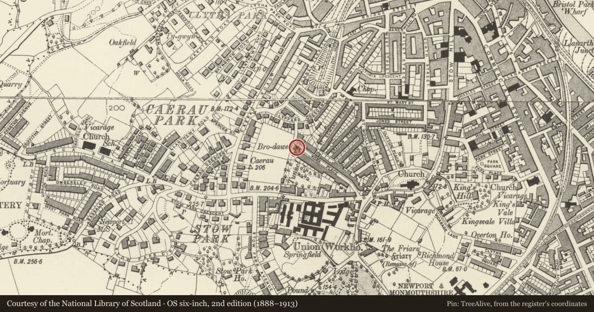
Slide toward Today to fade the historical sheet and see the modern map underneath.
David Rumsey Map Collection, Stanford LibrariesDavid Rumsey Map Collection, Stanford LibrariesDavid Rumsey Map Collection, Stanford LibrariesDavid Rumsey Map Collection, Stanford LibrariesDavid Rumsey Map Collection, Stanford Libraries
5 historical maps cover this location, the earliest the 1636 map "Cornubia : Devonia, Somersetus, Dorcestria, Wiltonia, Glocestria ..." (David Rumsey Map Collection, Stanford Libraries).
Historical maps covering this location
- 1636 · Cornubia : Devonia, Somersetus, Dorcestria, Wiltonia, Glocestria ... (David Rumsey Map Collection, Stanford Libraries)
- 1865 · England and Wales. England No. 6. (David Rumsey Map Collection, Stanford Libraries)
- 1895 · Sheet 11. Ordnance Survey of England and Wales. (David Rumsey Map Collection, Stanford Libraries)
- 1906 · 249 Newport (Hills) (David Rumsey Map Collection, Stanford Libraries)
- 1913 · Sheet 102. Newport. (David Rumsey Map Collection, Stanford Libraries)
Cadw's description
Location
At W end of York Place where road bends to join Clyffard Crescent.
History
Mid C19 house.
Exterior
Two storey 3-window house, stucco, slate roof with wide eaves. On first floor, 3 sash windows with marginal glazing. Central entrance with panelled door with panelled jambs, all covered by delicate iron porch with tented canopy. To each side of entrance, stone splayed bay window with camber-headed sash windows. Extension to L is now surgery.
Reason for designation
Well-preserved mid C19 house.
Nearby in the register
- Electricity Transformer at SW end of Graham StreetIndustrialunder 1 mi
- Stow Hill Railway TunnelTransportunder 1 mi
- Drinking Fountain to W of St Woolos' CathedralGardens, Parks and Urban Spacesunder 1 mi
- 7 & 8 Clifton PlaceDomesticunder 1 mi
Other entries of the same register within about three miles of this one, by straight line.