Cof Cymru: National Historic Assets of Wales · Wales
Church of St Mary Magdalene
Goldcliff, Newport, Wales
A Grade II listed building in Goldcliff, Newport, designated on 1 March 1963.
The record
- Designation
- Listed building, Grade II
- Broad class
- Religious, Ritual and Funerary
- Date of designation
- 1 March 1963
- Locality
- Goldcliff
- Town
- Newport
- Community
- Goldcliff
- Unitary authority
- Newport
- Country
- Wales
- Coordinates
- 51.54385, -2.91677
- Cadw reference
- 2912
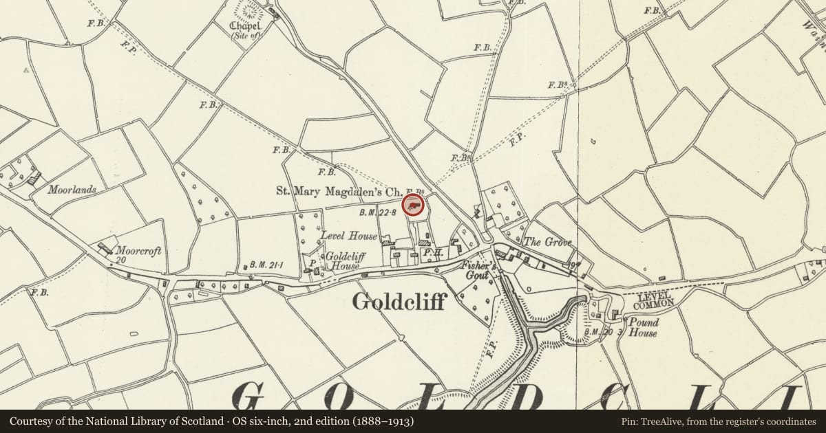
Slide toward Today to fade the historical sheet and see the modern map underneath.
David Rumsey Map Collection, Stanford LibrariesNational Library of ScotlandDavid Rumsey Map Collection, Stanford LibrariesDavid Rumsey Map Collection, Stanford LibrariesDavid Rumsey Map Collection, Stanford Libraries
5 historical maps cover this location, the earliest the 1636 map "Cornubia : Devonia, Somersetus, Dorcestria, Wiltonia, Glocestria ..." (David Rumsey Map Collection, Stanford Libraries).
Historical maps covering this location
- 1636 · Cornubia : Devonia, Somersetus, Dorcestria, Wiltonia, Glocestria ... (David Rumsey Map Collection, Stanford Libraries)
- 1865 · England and Wales. England No. 6. (David Rumsey Map Collection, Stanford Libraries)
- 1895 · Sheet 11. Ordnance Survey of England and Wales. (David Rumsey Map Collection, Stanford Libraries)
- 1913 · Sheet 102. Newport. (David Rumsey Map Collection, Stanford Libraries)
- 1963 · Map No. 2 - Local Government Commission for Wales : [Definitive maps showing proposed… (National Library of Scotland)
Cadw's description
Location
To rear of Farmers' Arms public house, in churchyard with stump of medieval cross, and C19 chest and table tombs.
History
Medieval Church. Nave said to be C12 with C14 tower; medieval porch, austere later C19 restoration.
Exterior
Yellow-brown stone, slate roofs. Undivided nave and chancel, W tower, S porch. Porch has C18 sundial in gable, entrance door boarded and nailed. To each side of porch, 2-light Decorated window (C19) and buttress. East window C19 3-light Decorated. No openings to N side, buttresses. Castellated tower with plain arched windows on 3 levels.
Interior
In nave, brass records "1606. On the XX day of January, even as it came to pas, it pleased God the flud did flow to the edge of this same bras, and in this parish there was lost 5000 and odd pounds besides XXII people was in this parish drownd ....".
Reason for designation
Included for special interest of medieval fabric.
Nearby in the register
- St. Mary Magdalene's Churchyard Cross, GoldcliffCrossunder 1 mi
- Goldcliff Moated House SiteMoated Siteunder 1 mi
- Goldcliff Pill Anti-invasion DefencesAnti-tank Obstacleunder 1 mi
- Samson CourtDomesticunder 1 mi
Other entries of the same register within about three miles of this one, by straight line.