Cof Cymru: National Historic Assets of Wales · Wales
Former Coach House at Bettws Lodge
Llanarth, Monmouthshire, Wales
A Grade II listed building in Bettws Newydd, Usk, Llanarth, Monmouthshire, designated on 8 June 1990.
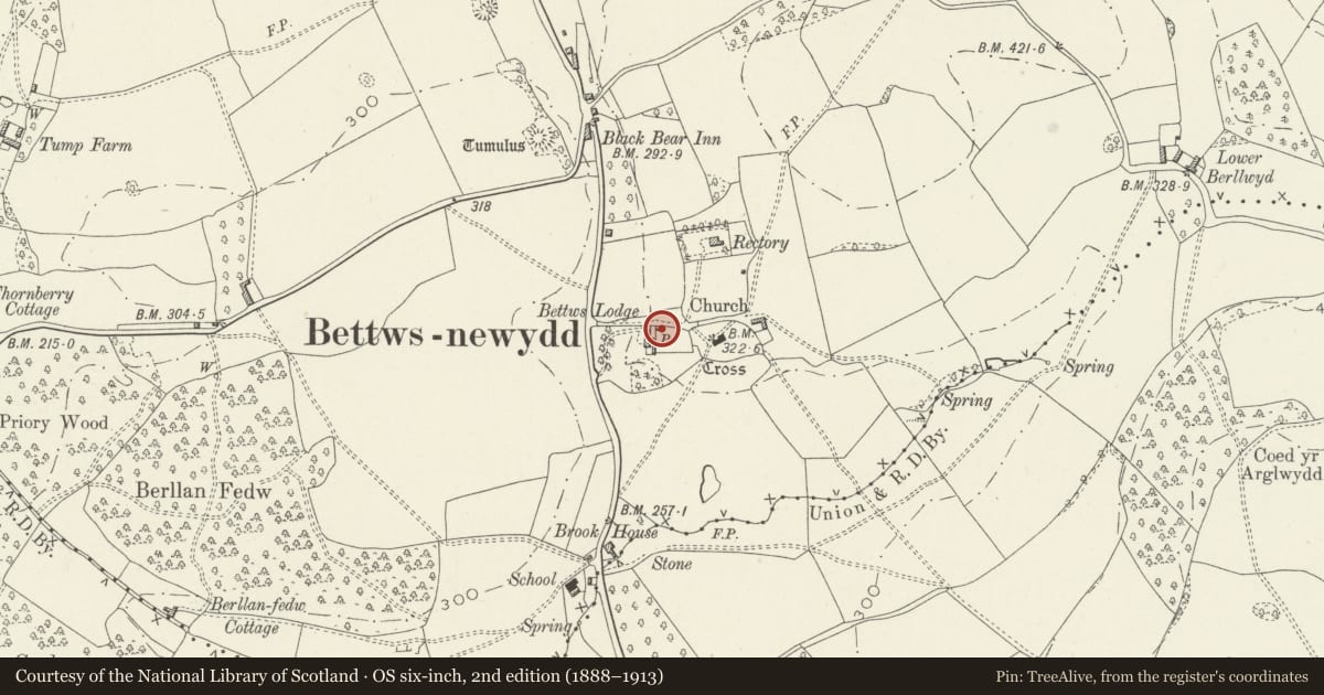
The record
- Designation
- Listed building, Grade II
- Broad class
- Domestic
- Date of designation
- 8 June 1990
- Locality
- Bettws Newydd
- Town
- Usk
- Community
- Llanarth
- Unitary authority
- Monmouthshire
- Country
- Wales
- Coordinates
- 51.74807, -2.92642
- Cadw reference
- 2835
Slide toward Today to fade the historical sheet and see the modern map underneath.
David Rumsey Map Collection, Stanford LibrariesDavid Rumsey Map Collection, Stanford LibrariesDavid Rumsey Map Collection, Stanford LibrariesDavid Rumsey Map Collection, Stanford LibrariesDavid Rumsey Map Collection, Stanford Libraries
5 historical maps cover this location, the earliest the 1636 map "Cornubia : Devonia, Somersetus, Dorcestria, Wiltonia, Glocestria ..." (David Rumsey Map Collection, Stanford Libraries).
Historical maps covering this location
- 1636 · Cornubia : Devonia, Somersetus, Dorcestria, Wiltonia, Glocestria ... (David Rumsey Map Collection, Stanford Libraries)
- 1895 · Sheet 11. Ordnance Survey of England and Wales. (David Rumsey Map Collection, Stanford Libraries)
- 1898 · 232 Abergavenny (Hills) (David Rumsey Map Collection, Stanford Libraries)
- 1898 · 232 Abergavenny (Outline) (David Rumsey Map Collection, Stanford Libraries)
- 1913 · Sheet 102. Newport. (David Rumsey Map Collection, Stanford Libraries)
Cadw's description
Location
Immediately to rear of the house at the NE corner.
History
Early to mid C19 coach house.
Exterior
Early to mid C19, probably contemporary with the house. Rubble construction with tall hipped slate roof. The front facing W has broad boarded gates and a small boarded loft door above. Rubble wall attached to left runs to entry from lane. Against the right hand wall is a low rubble chimney stack over a brick lined oven. Loft opening to centre of elevation facing the lane; blocked doorways below. Lean-to at rear.
Reason for designation
Included for group value with Bettws Lodge.
Nearby in the register
- Bettws LodgeDomesticunder 1 mi
- Mounting block at entry to Bettws Newydd churchyardTransportunder 1 mi
- Bettws Newydd ChurchReligious, Ritual and Funeraryunder 1 mi
- Cross in Bettws Newydd ChurchyardReligious, Ritual and Funeraryunder 1 mi
Other entries of the same register within about three miles of this one, by straight line.