Cof Cymru: National Historic Assets of Wales · Wales
Ye Olde Tippling Philosopher P.H.
Caldicot, Monmouthshire, Wales
A Grade II listed building in Caldicot, Monmouthshire, designated on 28 October 1976.
The record
- Designation
- Listed building, Grade II
- Broad class
- Commercial
- Date of designation
- 28 October 1976
- Locality
- Caldicot
- Town
- Caldicot
- Community
- Caldicot
- Unitary authority
- Monmouthshire
- Country
- Wales
- Coordinates
- 51.58922, -2.74260
- Cadw reference
- 2746
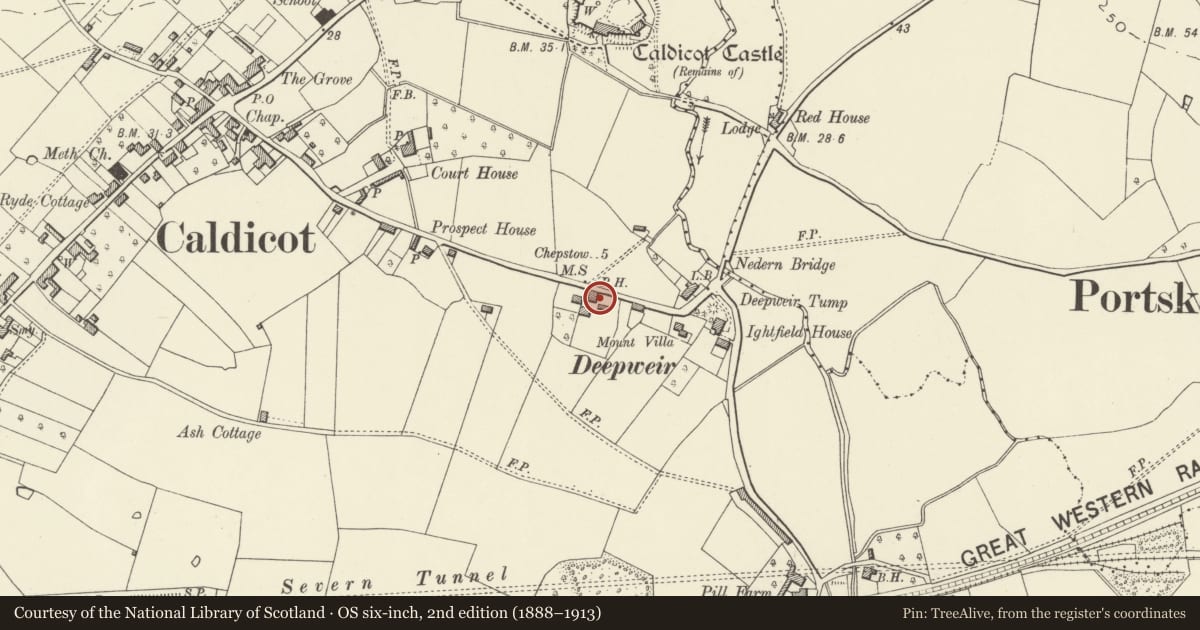
Slide toward Today to fade the historical sheet and see the modern map underneath.
David Rumsey Map Collection, Stanford LibrariesDavid Rumsey Map Collection, Stanford LibrariesDavid Rumsey Map Collection, Stanford LibrariesDavid Rumsey Map Collection, Stanford LibrariesDavid Rumsey Map Collection, Stanford Libraries
5 historical maps cover this location, the earliest the 1636 map "Cornubia : Devonia, Somersetus, Dorcestria, Wiltonia, Glocestria ..." (David Rumsey Map Collection, Stanford Libraries).
Historical maps covering this location
- 1636 · Cornubia : Devonia, Somersetus, Dorcestria, Wiltonia, Glocestria ... (David Rumsey Map Collection, Stanford Libraries)
- 1895 · Sheet 11. Ordnance Survey of England and Wales. (David Rumsey Map Collection, Stanford Libraries)
- 1897 · 250 Chepstow (Outline) (David Rumsey Map Collection, Stanford Libraries)
- 1905 · 250 Chepstow (Hills) (David Rumsey Map Collection, Stanford Libraries)
- 1913 · Sheet 102. Newport. (David Rumsey Map Collection, Stanford Libraries)
Cadw's description
Location
About 500m east of the centre of Caldicot village. Gable end to road with forecourt to right.
History
C18 origins, rebuilt in early to mid C19. Recently modernised including removal of external render. Local information shows that this was a public house by 1801 and that it had its own friendly society by 1837. Inquests into the deaths of workers on the great Severn Tunnel project of 1877-86 were held in this public house.
Exterior
Two-storey stripped rubble walls with rough quoins, yellow and red brick window surrounds plus an area of brick patching to first floor right. Blank gable end to road. Slate gabled roof without verges; rendered stack and external stone breast at south-west end. Entrance front with four 12-pane sash windows to first floor and, on ground floor, one of six vertical panes under stone lintel to left of offset doorway with arched vousoir lintol and boarded door. Three 16-pane windows to right in brick surrounds with keystones and panelled shutters internally.
Interior
The interior of the ground floor is all opened out as one bar and has two altered fireplaces.
Reason for designation
Included as an early/mid C19 public house with regional character and of some historic importance in relation to the workforce on the Severn Railway Tunnel.
Nearby in the register
- Prospect HouseDomesticunder 1 mi
- Court HouseDomesticunder 1 mi
- Castle LodgeDomesticunder 1 mi
- Caldicot CastleEducationunder 1 mi
Other entries of the same register within about three miles of this one, by straight line.