Cof Cymru: National Historic Assets of Wales · Wales
15&16 Upper Church Street
Chepstow, Monmouthshire, Wales
A Grade II listed building in Chepstow, Monmouthshire, designated on 12 November 2002.
The record
- Designation
- Listed building, Grade II
- Broad class
- Domestic
- Date of designation
- 12 November 2002
- Locality
- Chepstow
- Town
- Chepstow
- Community
- Chepstow
- Unitary authority
- Monmouthshire
- Country
- Wales
- Coordinates
- 51.64286, -2.67381
- Cadw reference
- 27098
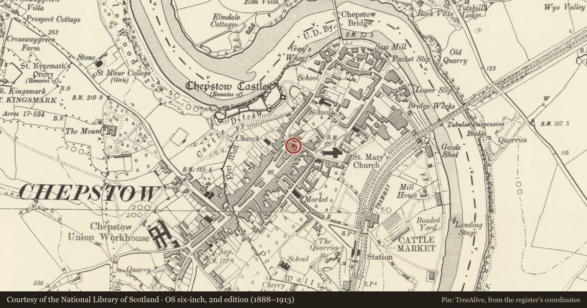
Slide toward Today to fade the historical sheet and see the modern map underneath.
David Rumsey Map Collection, Stanford LibrariesDavid Rumsey Map Collection, Stanford LibrariesDavid Rumsey Map Collection, Stanford LibrariesDavid Rumsey Map Collection, Stanford LibrariesDavid Rumsey Map Collection, Stanford Libraries
5 historical maps cover this location, the earliest the 1636 map "Cornubia : Devonia, Somersetus, Dorcestria, Wiltonia, Glocestria ..." (David Rumsey Map Collection, Stanford Libraries).
Historical maps covering this location
- 1636 · Cornubia : Devonia, Somersetus, Dorcestria, Wiltonia, Glocestria ... (David Rumsey Map Collection, Stanford Libraries)
- 1830 · V.3:11-15:XV.Britisches Reich. A. Kon: England. a. England ab sich: Shire:15-17, 33 (David Rumsey Map Collection, Stanford Libraries)
- 1895 · Sheet 11. Ordnance Survey of England and Wales. (David Rumsey Map Collection, Stanford Libraries)
- 1897 · 250 Chepstow (Outline) (David Rumsey Map Collection, Stanford Libraries)
- 1905 · 250 Chepstow (Hills) (David Rumsey Map Collection, Stanford Libraries)
Cadw's description
Location
The house between the corner properties of Middle Street and St Mary Street. Set back from the road behind a small walled courtyard and reached by a flight of stone steps.
History
C18.
Exterior
Large Georgian house in two apartments. Rendered and painted with pantile roof and brick end stacks. Three storeys and basement. Three-window front of horned sashes with cambered heads, 9 pane to top floor, 12-pane to first floor; ground floor has tripartite sashes either side of a central remodelled doorway with bracketed hood and overlight. Lead downpipe at right.
Reason for designation
Listed as a Georgian house range. Group value especially with the attached houses and others in Upper Church Street, Middle Street, the upper part of Bridge Street and St Mary Street.
Nearby in the register
- 16 St Mary StreetCommercialunder 1 mi
- 8 Middle StreetDomesticunder 1 mi
- Sir Walter Montague AlmshousesHealth and Welfareunder 1 mi
- 12 St Mary StreetCommercialunder 1 mi
Other entries of the same register within about three miles of this one, by straight line.