Cof Cymru: National Historic Assets of Wales · Wales
Sir Walter Montague Almshouses
Chepstow, Monmouthshire, Wales
A Grade II listed building in Chepstow, Monmouthshire, designated on 6 December 1950.
The record
- Designation
- Listed building, Grade II
- Broad class
- Health and Welfare
- Date of designation
- 6 December 1950
- Locality
- Chepstow
- Town
- Chepstow
- Community
- Chepstow
- Unitary authority
- Monmouthshire
- Country
- Wales
- Coordinates
- 51.64293, -2.67346
- Cadw reference
- 2590
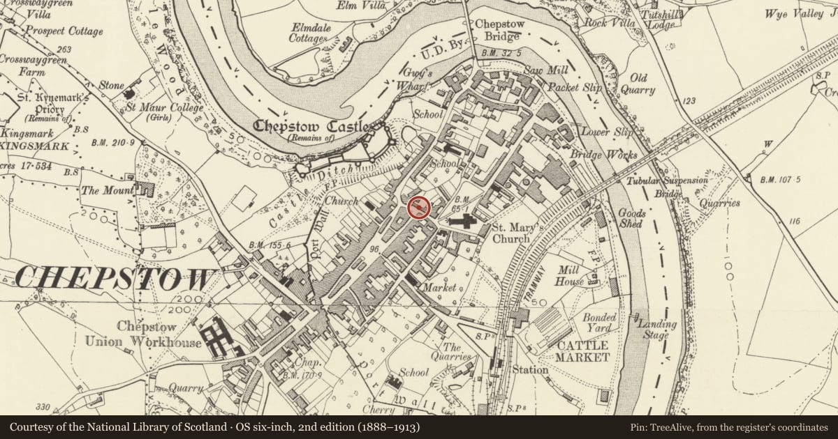
Slide toward Today to fade the historical sheet and see the modern map underneath.
David Rumsey Map Collection, Stanford LibrariesDavid Rumsey Map Collection, Stanford LibrariesDavid Rumsey Map Collection, Stanford LibrariesDavid Rumsey Map Collection, Stanford LibrariesDavid Rumsey Map Collection, Stanford Libraries
5 historical maps cover this location, the earliest the 1636 map "Cornubia : Devonia, Somersetus, Dorcestria, Wiltonia, Glocestria ..." (David Rumsey Map Collection, Stanford Libraries).
Historical maps covering this location
- 1636 · Cornubia : Devonia, Somersetus, Dorcestria, Wiltonia, Glocestria ... (David Rumsey Map Collection, Stanford Libraries)
- 1830 · V.3:11-15:XV.Britisches Reich. A. Kon: England. a. England ab sich: Shire:15-17, 33 (David Rumsey Map Collection, Stanford Libraries)
- 1895 · Sheet 11. Ordnance Survey of England and Wales. (David Rumsey Map Collection, Stanford Libraries)
- 1897 · 250 Chepstow (Outline) (David Rumsey Map Collection, Stanford Libraries)
- 1905 · 250 Chepstow (Hills) (David Rumsey Map Collection, Stanford Libraries)
Cadw's description
Location
Long range at the W end and downhill side of the street, opposite juction with St Mary Street
History
1699 with C19 and later remodelling. Virtually rebuilt retaining facade in 1955. List description of 1975 refers to 3 doorways to street frontage. Named after Sir William Montague whose will of 1614 provided for almshouses for five men and five women.
Exterior
C17 Almshouse range. Walls roughcast rendered and painted; slate roof with tall rendered square stacks with tall clustered pots. Consists of three 2-storey houses; five gables with short finials and eaves projecting between gables, decorative bargeboards. One window in each gable and 7 windows on ground floor, 3-light or 2-light leaded diamond-pane casements: wood frames with metal casements with moulded wooden mullions under hoodmoulds . Square-headed doorway with heavy moulded door frame and vertically panelled door with ornamental iron hinges. Painted plinth.
Reason for designation
Listed as an historic almshouse range of C17 origin. Group value with other listed buildings in Upper Church Street and St Mary Street.
Nearby in the register
- Griffin HouseDomesticunder 1 mi
- 16 St Mary StreetCommercialunder 1 mi
- 14 St Mary StreetCommercialunder 1 mi
- The First HurdleDomesticunder 1 mi
Other entries of the same register within about three miles of this one, by straight line.