Cof Cymru: National Historic Assets of Wales · Wales
Meiros
Llanbadarn Fawr, Ceredigion, Wales
A Grade II listed building in Llanbadarn Road, Aberystwyth, Llanbadarn Fawr, Ceredigion, designated on 25 October 2002.
The record
- Designation
- Listed building, Grade II
- Broad class
- Domestic
- Date of designation
- 25 October 2002
- Locality
- Llanbadarn Road
- Town
- Aberystwyth
- Community
- Llanbadarn Fawr
- Unitary authority
- Ceredigion
- Country
- Wales
- Coordinates
- 52.41114, -4.06723
- Cadw reference
- 27054
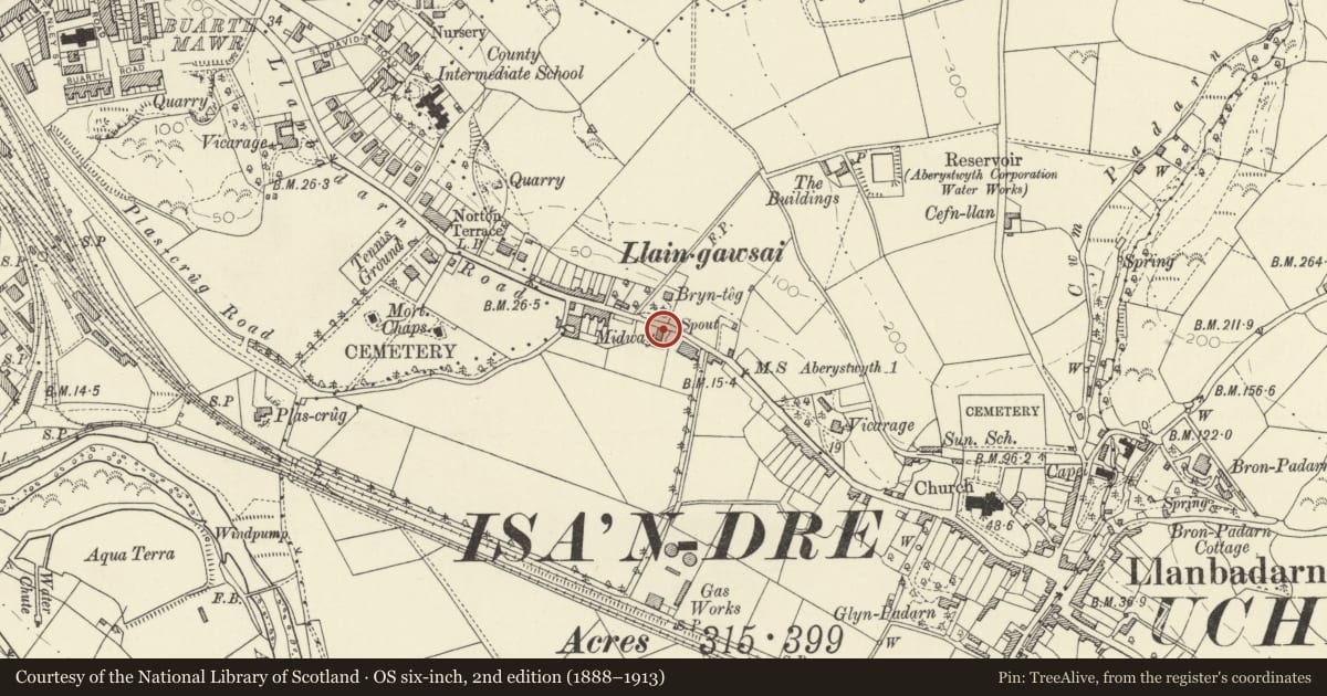
Slide toward Today to fade the historical sheet and see the modern map underneath.
David Rumsey Map Collection, Stanford LibrariesDavid Rumsey Map Collection, Stanford LibrariesDavid Rumsey Map Collection, Stanford LibrariesDavid Rumsey Map Collection, Stanford LibrariesDavid Rumsey Map Collection, Stanford Libraries
5 historical maps cover this location, the earliest the 1830 map "V.3:11-15:XV. Britisches Reich. A. Kon: England. b. Frstenthum Wales: Shire: 37-40" (David Rumsey Map Collection, Stanford Libraries).
Historical maps covering this location
- 1830 · V.3:11-15:XV. Britisches Reich. A. Kon: England. b. Frstenthum Wales: Shire: 37-40 (David Rumsey Map Collection, Stanford Libraries)
- 1883 · Watershed map England, Wales 3. (David Rumsey Map Collection, Stanford Libraries)
- 1896 · Sheet 7. Ordnance Survey of England and Wales. (David Rumsey Map Collection, Stanford Libraries)
- 1899 · 163 Aberystwyth (Hills) (David Rumsey Map Collection, Stanford Libraries)
- 1901 · Sheet 14. (David Rumsey Map Collection, Stanford Libraries)
Cadw's description
Location
Situated between Llanbadarn Fawr village and Aberystwyth on the S side of Llanbadarn Road.
History
Earlier C19 villa, the first such built between Aberystwyth and Llanbadarn Fawr, altered c1900 presumably with added bays. Originally called Midway House, the Rev. John Hughes of Midway House is listed in 1835 directory, Mrs Evans in 1858-9 directory, DA Silver in 1926.
Exterior
Villa, unpainted roughcast with slate eaves roof and rendered end stacks. Two storeys and attic, 3 bays, with paired brackets to flat eaves. Angle quoins. Two 2-storey bays to W front with 4-12-4-pane hornless sashes, panelled thin piers, and cornices over each floor, centre 12-pane hornless sash over C20 door with overlight in earlier timber surround with reeded thin half-column shafts and corniced hood on brackets. Two dormers with bargeboards and finials. Overhanging verges with brackets to end walls. C20 extension to S. Rear has 2 added timber oriel windows with horned sashes.
Interior
Not inspected.
Reason for designation
Included as a late Georgian house with later C19 alterations, one of the first villas on Llanbadarn Road.
Nearby in the register
- Milestone on S side of Llanbadarn RoadTransportunder 1 mi
- National Library of WalesRecreationalunder 1 mi
- Churchyard gate to SW of Church of St PadarnReligious, Ritual and Funeraryunder 1 mi
- Church of St PadarnReligious, Ritual and Funeraryunder 1 mi
Other entries of the same register within about three miles of this one, by straight line.