Cof Cymru: National Historic Assets of Wales · Wales
Fronlas Cowshed Range
Llanfihangel, Powys, Wales
A Grade II listed building in Tynrwtra, Welshpool, Llanfihangel, Powys, designated on 25 October 2002.
The record
- Designation
- Listed building, Grade II
- Broad class
- Agriculture and Subsistence
- Date of designation
- 25 October 2002
- Locality
- Tynrwtra
- Town
- Welshpool
- Community
- Llanfihangel
- Unitary authority
- Powys
- Country
- Wales
- Coordinates
- 52.74389, -3.41245
- Cadw reference
- 27046
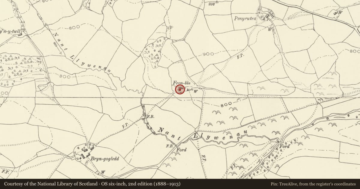
Slide toward Today to fade the historical sheet and see the modern map underneath.
David Rumsey Map Collection, Stanford LibrariesLlyfrgell Genedlaethol Cymru – The National Library of WalesDavid Rumsey Map Collection, Stanford LibrariesDavid Rumsey Map Collection, Stanford LibrariesDavid Rumsey Map Collection, Stanford Libraries
5 historical maps cover this location, the earliest the 1608 map "(13) Cambriae Typus." (David Rumsey Map Collection, Stanford Libraries).
Historical maps covering this location
- 1608 · (13) Cambriae Typus. (David Rumsey Map Collection, Stanford Libraries)
- 1637 · Particular description of Wales. Cambria seu Wallia (David Rumsey Map Collection, Stanford Libraries)
- 1795 · To Sir Watkin Williams-Wynn Bart ... the map of the six counties of North Wales is most… (Llyfrgell Genedlaethol Cymru – The National Library of Wales)
- 1883 · Watershed map England, Wales 3. (David Rumsey Map Collection, Stanford Libraries)
- 1901 · Sheet 9 and 10. (David Rumsey Map Collection, Stanford Libraries)
Cadw's description
Location
Adjacent to Fronlas farmhouse.
History
A farm range later than or possibly contemporary with the main range of Fronlas farmhouse and of C17 or C18 date. A construction joint at the rear suggests the southernmost bay may be later than the rest.
Exterior
The cowshed range standing at right angles to the west of the farmyard adjoins the domestic range corner to corner, and is planned slightly downslope away from the main range. Quasi-rubble masonry in small stones, slate roof with tile ridge.
At left of its front (east) elevation is a boarded door; from centre to right are three heck doors. Above the central door is a catslide dormer with a loft hatch. One central opening at rear. One window in gable wall with loft hatch above.
Interior
Cowhouse and workshop interiors.
Reason for designation
Part of an intact vernacular farmyard group of house and outbuildings, which have retained their character.
Nearby in the register
- FronlasAgriculture and Subsistenceunder 1 mi
- Fachwen-ganolDomesticunder 1 mi
- Pen-yr-alltAgriculture and Subsistence1 mi
- Ysgol EfyrnwyEducation1 mi
Other entries of the same register within about three miles of this one, by straight line.