Cof Cymru: National Historic Assets of Wales · Wales
Grotto in Wenvoe Castle Park
Barry, Vale of Glamorgan, Wales
A Grade II listed building in Wenvoe Castle Park, Barry, Vale of Glamorgan, designated on 21 October 2002.
The record
- Designation
- Listed building, Grade II
- Broad class
- Gardens, Parks and Urban Spaces
- Date of designation
- 21 October 2002
- Locality
- Wenvoe Castle Park
- Community
- Barry
- Unitary authority
- Vale of Glamorgan
- Country
- Wales
- Coordinates
- 51.43086, -3.27063
- Cadw reference
- 26997
Slide toward Today to fade the historical sheet and see the modern map underneath.
David Rumsey Map Collection, Stanford LibrariesDavid Rumsey Map Collection, Stanford LibrariesDavid Rumsey Map Collection, Stanford LibrariesDavid Rumsey Map Collection, Stanford LibrariesDavid Rumsey Map Collection, Stanford Libraries
5 historical maps cover this location, the earliest the 1636 map "Cornubia : Devonia, Somersetus, Dorcestria, Wiltonia, Glocestria ..." (David Rumsey Map Collection, Stanford Libraries).
Historical maps covering this location
- 1636 · Cornubia : Devonia, Somersetus, Dorcestria, Wiltonia, Glocestria ... (David Rumsey Map Collection, Stanford Libraries)
- 1637 · The fourth table of England. Cornub. Devonia, Somerset etc. (David Rumsey Map Collection, Stanford Libraries)
- 1865 · England and Wales. England No. 6. (David Rumsey Map Collection, Stanford Libraries)
- 1898 · 263 Cardiff (Hills) (David Rumsey Map Collection, Stanford Libraries)
- 1913 · Sheet 110. Cardiff & Mouth of the Severn. (David Rumsey Map Collection, Stanford Libraries)
Cadw's description
Location
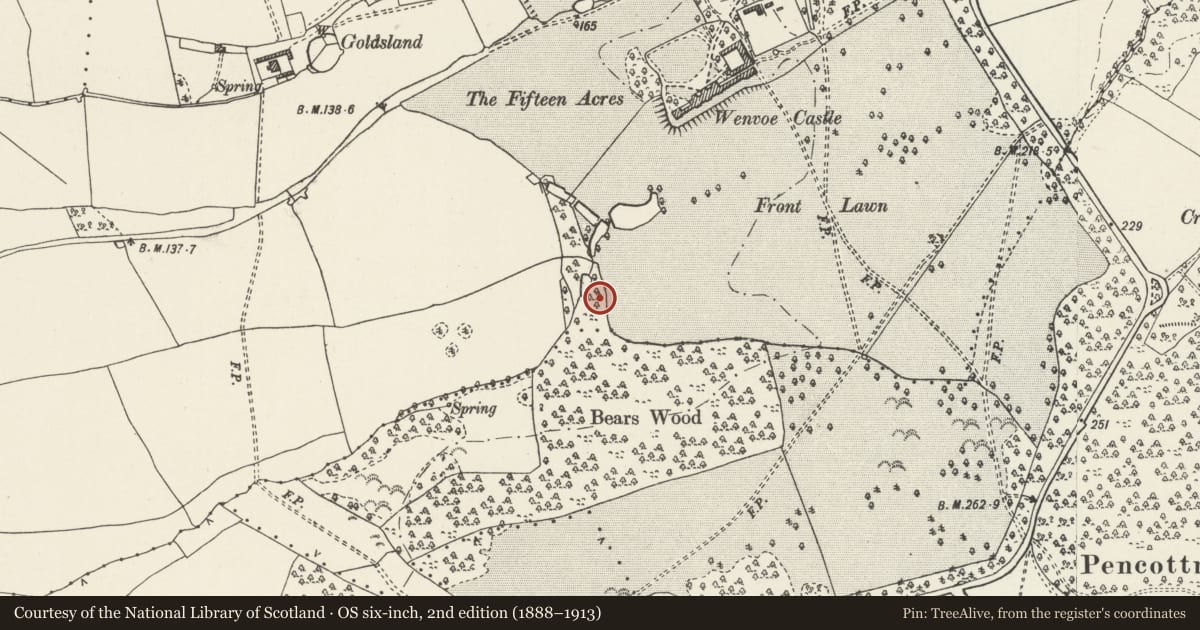
SW of the former castle in a tongue of woodland extending N from Bears Wood, close to the lake.
History
The Park at Wenvoe was largely the creation of Sir Edmund Thomas, third baronet, between 1733 when he inherited the estate and his death in 1767. The most interesting part of this mid C18 park is Bears Wood, laid out in Rococo style with intersecting rides leading to circular clearings, large at centre. In the tongue of the wood at the N end the estate map of 1762 shows a Grotto, serpentine Canal and a Green.
Exterior
The grotto of stone rubble with roughly dressed quoins, partly covered by an earth mound, consists of a chamber with a rusticated roughly rendered interior, entered through segmental arches at front and back; stone vault.
Reason for designation
Listed as a very rare example of this type of C18 park and garden architecture in Wales.
Nearby in the register
- Former coach-house and stables at Wenvoe CastleRecreationalunder 1 mi
- Former walled kitchen garden wall at Wenvoe Castle- W rangeGardens, Parks and Urban Spacesunder 1 mi
- Barn at Goldsland FarmAgriculture and Subsistenceunder 1 mi
- Church of St Dyfan and St TeiloReligious, Ritual and Funeraryunder 1 mi
Other entries of the same register within about three miles of this one, by straight line.