Cof Cymru: National Historic Assets of Wales · Wales
2 Tai Cochion
Nannerch, Flintshire, Wales
A Grade II listed building in Nannerch, Flintshire, designated on 30 August 2002.
The record
- Designation
- Listed building, Grade II
- Broad class
- Domestic
- Date of designation
- 30 August 2002
- Locality
- Nannerch
- Community
- Nannerch
- Unitary authority
- Flintshire
- Country
- Wales
- Coordinates
- 53.21597, -3.25025
- Cadw reference
- 26907
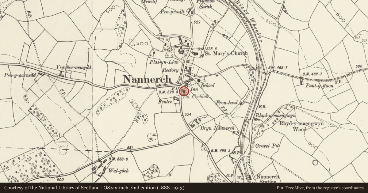
Slide toward Today to fade the historical sheet and see the modern map underneath.
David Rumsey Map Collection, Stanford LibrariesDavid Rumsey Map Collection, Stanford LibrariesDavid Rumsey Map Collection, Stanford LibrariesDavid Rumsey Map Collection, Stanford LibrariesLlyfrgell Genedlaethol Cymru – The National Library of Wales
5 historical maps cover this location, the earliest the 1795 map "To Sir Watkin Williams-Wynn Bart ... the map of the six counties of North Wales is most humbly inscribed by his obedient humble servant" (Llyfrgell Genedlaethol Cymru – The National Library of Wales).
Historical maps covering this location
- 1795 · To Sir Watkin Williams-Wynn Bart ... the map of the six counties of North Wales is most… (Llyfrgell Genedlaethol Cymru – The National Library of Wales)
- 1883 · Watershed map England, Wales 3. (David Rumsey Map Collection, Stanford Libraries)
- 1898 · 108 Flint (Hills) (David Rumsey Map Collection, Stanford Libraries)
- 1898 · 108 Flint (Outline) (David Rumsey Map Collection, Stanford Libraries)
- 1901 · Sheet 9 and 10. (David Rumsey Map Collection, Stanford Libraries)
Cadw's description
Location
Set back from the road S of the Cross Foxes public house.
History
Built in 1877-8 for William Barber Buddicom of Penbedw by John Douglas, architect of Chester.
Reason for designation
Listed as one of a pair of striking vernacular estate cottages retaining original character and detail, and for its contribution to the historic character of the village.
Nearby in the register
- 1 Tai CochionDomesticunder 1 mi
- Telephone Call-box at entrance to Cross Foxes public houseCommunicationsunder 1 mi
- Nannerch war memorialCommemorativeunder 1 mi
- Tyn-LlanDomesticunder 1 mi
Other entries of the same register within about three miles of this one, by straight line.