Cof Cymru: National Historic Assets of Wales · Wales
Vaulted undercroft at Cilciffeth
Cwm Gwaun, Pembrokeshire, Wales
A Grade II listed building in Cilciffeth, Fishguard, Cwm Gwaun, Pembrokeshire, designated on 30 July 2002.
The record
- Designation
- Listed building, Grade II
- Broad class
- Domestic
- Date of designation
- 30 July 2002
- Locality
- Cilciffeth
- Town
- Fishguard
- Community
- Cwm Gwaun
- Unitary authority
- Pembrokeshire
- Country
- Wales
- Coordinates
- 51.96634, -4.89523
- Cadw reference
- 26813
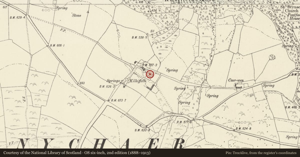
Slide toward Today to fade the historical sheet and see the modern map underneath.
David Rumsey Map Collection, Stanford LibrariesDavid Rumsey Map Collection, Stanford LibrariesDavid Rumsey Map Collection, Stanford LibrariesDavid Rumsey Map Collection, Stanford LibrariesDavid Rumsey Map Collection, Stanford Libraries
5 historical maps cover this location, the earliest the 1608 map "(13) Cambriae Typus." (David Rumsey Map Collection, Stanford Libraries).
Historical maps covering this location
- 1608 · (13) Cambriae Typus. (David Rumsey Map Collection, Stanford Libraries)
- 1891 · Sheet 10. Ordnance Survey of England and Wales. . (David Rumsey Map Collection, Stanford Libraries)
- 1898 · 210 Cardigan (Hills) (David Rumsey Map Collection, Stanford Libraries)
- 1898 · 210 Cardigan (Outline) (David Rumsey Map Collection, Stanford Libraries)
- 1901 · Sheet 13. (David Rumsey Map Collection, Stanford Libraries)
Cadw's description
Location
Situated in garden some 20m SE of house.
History
Vaulted undercroft, the remnant of a very sizeable structure, assumed to be part of the mansion of Cilciffeth, whose greatest period of importance was when held by the Lloyd family in the C16 and to 1631. The present farmhouse has C17 elements but is to a much smaller scale, and the fragment of fine carved stone built into one corner suggests that it was built with fragments from something much more important.
Exterior
Vaulted undercroft, rubble stone curved barrel vault some 12 m long. Eroded and overgrown outside walls, open entry at one end, vent loop at other. No trace of original external-wall facing masonry, remnants of 2 windows and door.
Reason for designation
Included as a substantial vaulted undercroft of sub-medieval date, remnant of one of the larger North Pembrokeshire houses.
Nearby in the register
- CilciffethDomesticunder 1 mi
- Five Pillar-Crosses in ChurchyardCross-marked stoneunder 1 mi
- Iron Age Enclosure in Kilkiffeth WoodEnclosureunder 1 mi
- Cwm LlanDomesticunder 1 mi
Other entries of the same register within about three miles of this one, by straight line.