Cof Cymru: National Historic Assets of Wales · Wales
Lime kiln
Llaneugrad, Isle of Anglesey, Wales
A Grade II listed building in Traeth Bychan, Llaneugrad, Isle of Anglesey, designated on 2 May 2002.
The record
- Designation
- Listed building, Grade II
- Broad class
- Industrial
- Date of designation
- 2 May 2002
- Locality
- Traeth Bychan
- Community
- Llaneugrad
- Unitary authority
- Isle of Anglesey
- Country
- Wales
- Coordinates
- 53.33701, -4.23134
- Cadw reference
- 26651
Slide toward Today to fade the historical sheet and see the modern map underneath.
David Rumsey Map Collection, Stanford LibrariesDavid Rumsey Map Collection, Stanford LibrariesDavid Rumsey Map Collection, Stanford LibrariesDavid Rumsey Map Collection, Stanford LibrariesDavid Rumsey Map Collection, Stanford Libraries
5 historical maps cover this location, the earliest the 1883 map "Watershed map England, Wales 3." (David Rumsey Map Collection, Stanford Libraries).
Historical maps covering this location
- 1883 · Watershed map England, Wales 3. (David Rumsey Map Collection, Stanford Libraries)
- 1896 · Sheet 7. Ordnance Survey of England and Wales. (David Rumsey Map Collection, Stanford Libraries)
- 1899 · 93 Holyhead (Hills) (David Rumsey Map Collection, Stanford Libraries)
- 1901 · Sheet 9 and 10. (David Rumsey Map Collection, Stanford Libraries)
- 1919 · Sheet 41. Anglesey. (David Rumsey Map Collection, Stanford Libraries)
Cadw's description
Location
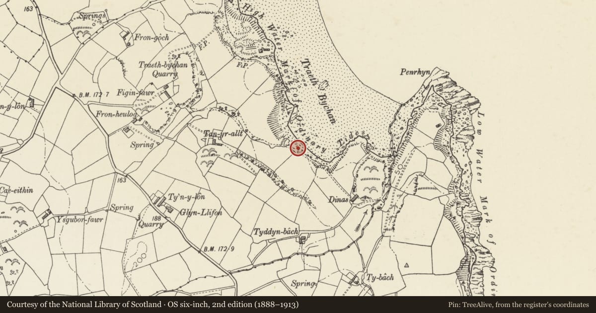
Located at the high water line on the shore of Traeth Bychan.
History
C19- Probably early C19 lime kiln. The shipping of limestone and its processing for agricultural use was an important industry of coastal Wales.
Exterior
Substantially complete rectangular stone lime kiln built into the cliff face at the edge of the bay. Constructed of coursed, roughly dressed stone with large quoins and advanced dripcourse. The main opening faces the sea (E) and opens into a ruined walled yard with doorway in the NE corner; another opening faces N. Both openings have round heads, that to N with brick dressings.
Interior
There are 2 brick lined recesses in the S wall; that to the rear with iron base plate.
Reason for designation
Listed as a good surviving lime kiln of the region, of historical value as a substantial surviving structure of an important industry associated with Welsh coastal areas.
Nearby in the register
- Lime kilnIndustrialunder 1 mi
- Cottage at Fron HeulogDomesticunder 1 mi
- Lofted stable and cartshed at HendyAgriculture and Subsistenceunder 1 mi
- HendyDomesticunder 1 mi
Other entries of the same register within about three miles of this one, by straight line.