Cof Cymru: National Historic Assets of Wales · Wales
Railings to Frogmore Terrace
Tenby, Pembrokeshire, Wales
A Grade II listed building in Tenby, Pembrokeshire, designated on 26 April 1977.
The record
- Designation
- Listed building, Grade II
- Broad class
- Gardens, Parks and Urban Spaces
- Date of designation
- 26 April 1977
- Town
- Tenby
- Community
- Tenby
- Unitary authority
- Pembrokeshire
- Country
- Wales
- Coordinates
- 51.67016, -4.69923
- Cadw reference
- 26381
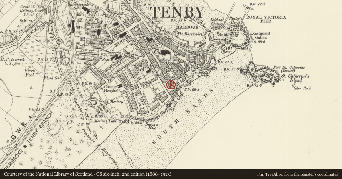
Slide toward Today to fade the historical sheet and see the modern map underneath.
David Rumsey Map Collection, Stanford LibrariesDavid Rumsey Map Collection, Stanford LibrariesDavid Rumsey Map Collection, Stanford LibrariesDavid Rumsey Map Collection, Stanford LibrariesDavid Rumsey Map Collection, Stanford Libraries
5 historical maps cover this location, the earliest the 1636 map "Cornubia : Devonia, Somersetus, Dorcestria, Wiltonia, Glocestria ..." (David Rumsey Map Collection, Stanford Libraries).
Historical maps covering this location
- 1636 · Cornubia : Devonia, Somersetus, Dorcestria, Wiltonia, Glocestria ... (David Rumsey Map Collection, Stanford Libraries)
- 1865 · England and Wales. England No. 6. (David Rumsey Map Collection, Stanford Libraries)
- 1891 · Sheet 10. Ordnance Survey of England and Wales. . (David Rumsey Map Collection, Stanford Libraries)
- 1898 · 245 Pembroke (Hills) (David Rumsey Map Collection, Stanford Libraries)
- 1901 · Sheet 13. (David Rumsey Map Collection, Stanford Libraries)
Cadw's description
Location
On the street line on the SW side of Lower Frog Street, in front of 1 - 4 Frogmore Terrace.
History
Forecourt railings and gates to Frogmore Terrace, built c1830-40. Spearhead rails are similar to some on the S side of St Mary's churchyard.
Exterior
Spearhead iron railings on low rendered rubble stone wall with slate copings. Rails have split iron spearheads like those on the S side of the churchyard. Four matching gates between plain uprights upheld by scrolled iron supports.
Reason for designation
Included for group value with Frogmore Terrace, and as good earlier C19 ironwork.
Nearby in the register
- No 2 Frogmore TerraceDomesticunder 1 mi
- No 3 Frogmore TerraceDomesticunder 1 mi
- No 1 Frogmore TerraceDomesticunder 1 mi
- No 4 Frogmore TerraceDomesticunder 1 mi
Other entries of the same register within about three miles of this one, by straight line.