Cof Cymru: National Historic Assets of Wales · Wales
Gate Piers and attached Walls at entrance to Gwysaney
Halkyn, Flintshire, Wales
A Grade II listed building in Gwysaney, Holywell, Halkyn, Flintshire, designated on 31 January 2002.
The record
- Designation
- Listed building, Grade II
- Broad class
- Gardens, Parks and Urban Spaces
- Date of designation
- 31 January 2002
- Locality
- Gwysaney
- Town
- Holywell
- Community
- Halkyn
- Unitary authority
- Flintshire
- Country
- Wales
- Coordinates
- 53.18106, -3.15770
- Cadw reference
- 26174
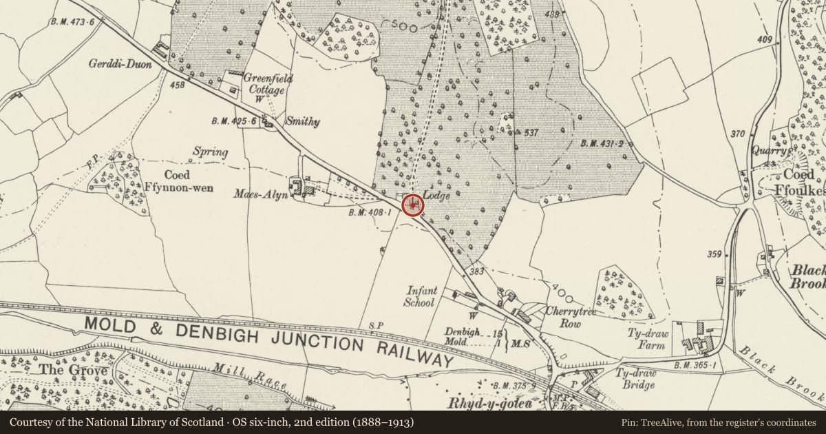
Slide toward Today to fade the historical sheet and see the modern map underneath.
David Rumsey Map Collection, Stanford LibrariesDavid Rumsey Map Collection, Stanford LibrariesDavid Rumsey Map Collection, Stanford LibrariesDavid Rumsey Map Collection, Stanford LibrariesLlyfrgell Genedlaethol Cymru – The National Library of Wales
5 historical maps cover this location, the earliest the 1795 map "To Sir Watkin Williams-Wynn Bart ... the map of the six counties of North Wales is most humbly inscribed by his obedient humble servant" (Llyfrgell Genedlaethol Cymru – The National Library of Wales).
Historical maps covering this location
- 1795 · To Sir Watkin Williams-Wynn Bart ... the map of the six counties of North Wales is most… (Llyfrgell Genedlaethol Cymru – The National Library of Wales)
- 1883 · Watershed map England, Wales 3. (David Rumsey Map Collection, Stanford Libraries)
- 1898 · 108 Flint (Hills) (David Rumsey Map Collection, Stanford Libraries)
- 1898 · 108 Flint (Outline) (David Rumsey Map Collection, Stanford Libraries)
- 1901 · Sheet 9 and 10. (David Rumsey Map Collection, Stanford Libraries)
Cadw's description
Location
On the N side of the A541 at the main entrance to Gwysaney.
History
Gwysaney is a Jacobean mansion built in 1603. From the late C17 to the early C19 the house was occupied by tenants, but in 1821 it was inherited by Philip Davies-Cooke. The Estate was subsequently revived, together with the park and gardens associated with the house. The gate piers were probably built c1841 with the adjacent lodge was built, and when it became the main entrance to the house.
Exterior
Square piers of coursed hammer-dressed stone, with pyramidal caps and broad low moulded finials. Convex flanking walls have saddleback copings. The walls curve outwards and terminate with piers similar to the main gateway. Low rubble-stone walls are attached at both ends.
Reason for designation
Listed as well-detailed mid C19 gate piers, and for group value with Gwysaney Lodge and other listed items at Gwysaney.
Nearby in the register
- Gwysaney LodgeDomesticunder 1 mi
- Tan yr AlltDomesticunder 1 mi
- 5 Red HousesDomesticunder 1 mi
- 4 Red HousesDomesticunder 1 mi
Other entries of the same register within about three miles of this one, by straight line.