Cof Cymru: National Historic Assets of Wales · Wales
Lime Kilns
Halkyn, Flintshire, Wales
A Grade II listed building in Halkyn Mountain, Holywell, Halkyn, Flintshire, designated on 31 January 2002.
The record
- Designation
- Listed building, Grade II
- Broad class
- Industrial
- Date of designation
- 31 January 2002
- Locality
- Halkyn Mountain
- Town
- Holywell
- Community
- Halkyn
- Unitary authority
- Flintshire
- Country
- Wales
- Coordinates
- 53.22930, -3.20512
- Cadw reference
- 26149
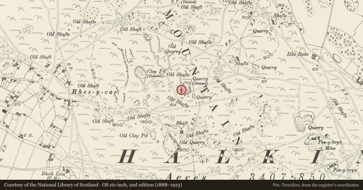
Slide toward Today to fade the historical sheet and see the modern map underneath.
David Rumsey Map Collection, Stanford LibrariesDavid Rumsey Map Collection, Stanford LibrariesDavid Rumsey Map Collection, Stanford LibrariesDavid Rumsey Map Collection, Stanford LibrariesLlyfrgell Genedlaethol Cymru – The National Library of Wales
5 historical maps cover this location, the earliest the 1795 map "To Sir Watkin Williams-Wynn Bart ... the map of the six counties of North Wales is most humbly inscribed by his obedient humble servant" (Llyfrgell Genedlaethol Cymru – The National Library of Wales).
Historical maps covering this location
- 1795 · To Sir Watkin Williams-Wynn Bart ... the map of the six counties of North Wales is most… (Llyfrgell Genedlaethol Cymru – The National Library of Wales)
- 1883 · Watershed map England, Wales 3. (David Rumsey Map Collection, Stanford Libraries)
- 1898 · 108 Flint (Hills) (David Rumsey Map Collection, Stanford Libraries)
- 1898 · 108 Flint (Outline) (David Rumsey Map Collection, Stanford Libraries)
- 1901 · Sheet 9 and 10. (David Rumsey Map Collection, Stanford Libraries)
Cadw's description
Location
On Halkyn Mountain, approximately 0.7km E of Rhes-y-cae village on the N side of a minor road between Rhes-y-cae and Halkyn. A quarry is on the E side of the kilns.
History
Built after a lease to open a small limestone quarry was obtained by Robert Jones in 1879. The quarry is on the E side of the kilns.
Exterior
A pair of rubble stone kilns set within a quarried-out depression. The kilns face W, have stone W and S walls, while the N and E sides are built into a bank (with quarried face exposed to the E). The segmental draw arches are of brick. The L-hand (N) kiln has a collapsed draw hole, while the draw arch of the R-hand kiln is almost completely infilled. The kilns are both brick lined, but infilled and partly collapsed.
Reason for designation
Listed for industrial archaeological interest as rare surviving, prominently located kilns, representing an important local industry.
Nearby in the register
- Bryn IdrisDomesticunder 1 mi
- Hen Rake, including attached Garden and Yard WallsDomesticunder 1 mi
- Black Lion FarmDomesticunder 1 mi
- Stable at Black Lion FarmAgriculture and Subsistenceunder 1 mi
Other entries of the same register within about three miles of this one, by straight line.