Cof Cymru: National Historic Assets of Wales · Wales
Moss Hut
Trallong, Powys, Wales
A Grade II listed building in Penpont, Brecon, Trallong, Powys, designated on 18 January 2002.
The record
- Designation
- Listed building, Grade II
- Broad class
- Gardens, Parks and Urban Spaces
- Date of designation
- 18 January 2002
- Locality
- Penpont
- Town
- Brecon
- Community
- Trallong
- Unitary authority
- Powys
- Country
- Wales
- Coordinates
- 51.94690, -3.49853
- Cadw reference
- 26100
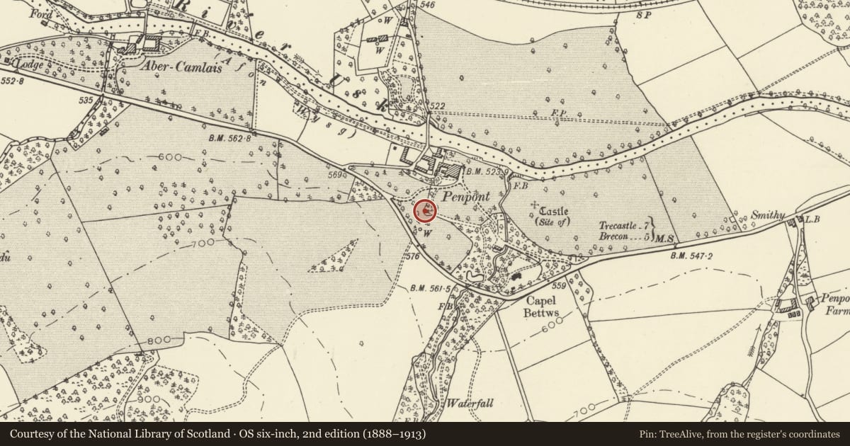
Slide toward Today to fade the historical sheet and see the modern map underneath.
David Rumsey Map Collection, Stanford LibrariesDavid Rumsey Map Collection, Stanford LibrariesDavid Rumsey Map Collection, Stanford LibrariesDavid Rumsey Map Collection, Stanford LibrariesDavid Rumsey Map Collection, Stanford Libraries
5 historical maps cover this location, the earliest the 1636 map "Cornubia : Devonia, Somersetus, Dorcestria, Wiltonia, Glocestria ..." (David Rumsey Map Collection, Stanford Libraries).
Historical maps covering this location
- 1636 · Cornubia : Devonia, Somersetus, Dorcestria, Wiltonia, Glocestria ... (David Rumsey Map Collection, Stanford Libraries)
- 1830 · V.3:11-15:XV. Britisches Reich. A. Kon: England. b. Frstenthum Wales: Shire: 37-40 (David Rumsey Map Collection, Stanford Libraries)
- 1856 · 42. Brecon. (David Rumsey Map Collection, Stanford Libraries)
- 1898 · 213 Brecon (Hills) (David Rumsey Map Collection, Stanford Libraries)
- 1901 · Sheet 14. (David Rumsey Map Collection, Stanford Libraries)
Cadw's description
Location
Situated at SW corner of lawn to S of house, just NW of maze.
History
Remnant of a garden seat. A building is known from maps to have been on this site in 1738, either a garden structure or associated with old road which ran nearby. In present form, with rustic panelling probably dates from early C19.
Exterior
Garden seat, circular plan, open fronted with semi-circular curved rubble stone back wall. The roof dismantled at time of inspection, was stone tiled. Inner walls have patterned rustic panelling in small split logs, mounted on pine boarding, in poor condition. Raised flagstone floor.
Reason for designation
Included despite present condition as an early C19 garden seat, part of the early C19 gardens at Penpont.
Nearby in the register
- Sundial on lawn to S of PenpontGardens, Parks and Urban Spacesunder 1 mi
- Gatepiers and flanking ranges to rear courtyard at PenpontGardens, Parks and Urban Spacesunder 1 mi
- Workshop block at PenpontAgriculture and Subsistenceunder 1 mi
- The StablesDomesticunder 1 mi
Other entries of the same register within about three miles of this one, by straight line.