Cof Cymru: National Historic Assets of Wales · Wales
Gatepiers and flanking ranges to rear courtyard at Penpont
Trallong, Powys, Wales
A Grade II listed building in Penpont, Brecon, Trallong, Powys, designated on 27 May 2005.
The record
- Designation
- Listed building, Grade II
- Broad class
- Gardens, Parks and Urban Spaces
- Date of designation
- 27 May 2005
- Locality
- Penpont
- Town
- Brecon
- Community
- Trallong
- Unitary authority
- Powys
- Country
- Wales
- Coordinates
- 51.94756, -3.49832
- Cadw reference
- 84444
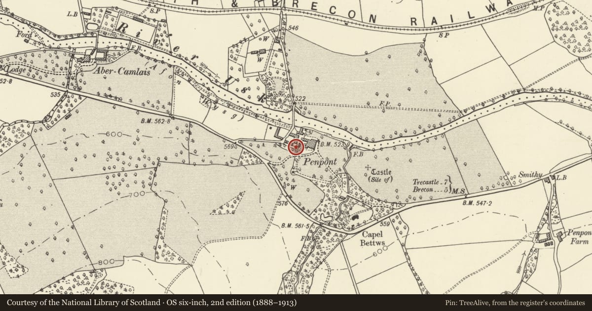
Slide toward Today to fade the historical sheet and see the modern map underneath.
David Rumsey Map Collection, Stanford LibrariesDavid Rumsey Map Collection, Stanford LibrariesDavid Rumsey Map Collection, Stanford LibrariesDavid Rumsey Map Collection, Stanford LibrariesDavid Rumsey Map Collection, Stanford Libraries
5 historical maps cover this location, the earliest the 1636 map "Cornubia : Devonia, Somersetus, Dorcestria, Wiltonia, Glocestria ..." (David Rumsey Map Collection, Stanford Libraries).
Historical maps covering this location
- 1636 · Cornubia : Devonia, Somersetus, Dorcestria, Wiltonia, Glocestria ... (David Rumsey Map Collection, Stanford Libraries)
- 1830 · V.3:11-15:XV. Britisches Reich. A. Kon: England. b. Frstenthum Wales: Shire: 37-40 (David Rumsey Map Collection, Stanford Libraries)
- 1856 · 42. Brecon. (David Rumsey Map Collection, Stanford Libraries)
- 1898 · 213 Brecon (Hills) (David Rumsey Map Collection, Stanford Libraries)
- 1901 · Sheet 14. (David Rumsey Map Collection, Stanford Libraries)
Cadw's description
Location
Situated at S entrance to rear courtyard at Penpont.
History
Two large stone walls framing the rear drive to Penpont, the upper walling stepped back in a big double curve. Probably C18. The plain lean-to ranges flanking the entrance to the yard have an intended symmetry.
Exterior
Two tall stone walls at right angles to drive, with impost string course, under tall tops, sloped back in an ogee curve. Attached to N, flanking entrance to the rear courtyard, are narrow lean-to ranges running N. The lean-tos have slate roofs, and the N ends are curved outward with doors, the W one with stone voussoirs, the E one with timber lintel. Rear of E range is rubble stone with window, door and window to left. Deep pit within. The gatepiers frame a pair of detached cast-iron late C19 gate posts with iron double gates.
Reason for designation
Included for group value with the other buildings in the rear court at Penpont.
Nearby in the register
- The StablesDomesticunder 1 mi
- Workshop block at PenpontAgriculture and Subsistenceunder 1 mi
- Sundial on lawn to S of PenpontGardens, Parks and Urban Spacesunder 1 mi
- The Old Granary and the Old LaundryAgriculture and Subsistenceunder 1 mi
Other entries of the same register within about three miles of this one, by straight line.