Cof Cymru: National Historic Assets of Wales · Wales
47 High Street
Fishguard and Goodwick, Pembrokeshire, Wales
A Grade II listed building in Fishguard, Fishguard and Goodwick, Pembrokeshire, designated on 24 November 1978.
The record
- Designation
- Listed building, Grade II
- Broad class
- Domestic
- Date of designation
- 24 November 1978
- Locality
- Fishguard
- Town
- Fishguard
- Community
- Fishguard and Goodwick
- Unitary authority
- Pembrokeshire
- Country
- Wales
- Coordinates
- 51.99217, -4.97919
- Cadw reference
- 26050
Slide toward Today to fade the historical sheet and see the modern map underneath.
David Rumsey Map Collection, Stanford LibrariesDavid Rumsey Map Collection, Stanford LibrariesDavid Rumsey Map Collection, Stanford LibrariesDavid Rumsey Map Collection, Stanford LibrariesDavid Rumsey Map Collection, Stanford Libraries
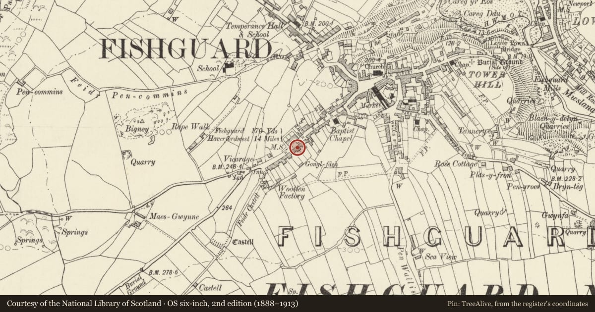
5 historical maps cover this location, the earliest the 1608 map "(13) Cambriae Typus." (David Rumsey Map Collection, Stanford Libraries).
Historical maps covering this location
- 1608 · (13) Cambriae Typus. (David Rumsey Map Collection, Stanford Libraries)
- 1891 · Sheet 10. Ordnance Survey of England and Wales. . (David Rumsey Map Collection, Stanford Libraries)
- 1898 · 210 Cardigan (Hills) (David Rumsey Map Collection, Stanford Libraries)
- 1898 · 210 Cardigan (Outline) (David Rumsey Map Collection, Stanford Libraries)
- 1901 · Sheet 13. (David Rumsey Map Collection, Stanford Libraries)
Cadw's description
Location
Situated in terraced row set back from the street line, between Nos 45 and 49.
History
Early to mid C19 small terraced house, possibly built as a service wing to the larger No 45 to left. Building shown on this site on 1844 tithe map. From the placement of the stack, it would appear that No 47 terminated the row and that the gap between it and No 49 has been infilled at a later date.
Exterior
Terraced house, colourwashed stucco cladding, with imitation slate roof, bracketed eaves and stone end right end stack. Two-storey, 2-window range with openings offset to left, upper floor with 2 small 4-pane sash windows. Ground floor with centre C20 3-light sash window of 2-4-2 panes and doorway to extreme left with C20 4-panelled door.
In previous listing house was pebbledashed, door was 6-panelled and roof was grouted cement.
Reason for designation
Included for group value with No 45 High Street.
Nearby in the register
- Old Pump HouseDomesticunder 1 mi
- Llys-TegDomesticunder 1 mi
- 43 High StreetDomesticunder 1 mi
- Mount PleasantDomesticunder 1 mi
Other entries of the same register within about three miles of this one, by straight line.