Cof Cymru: National Historic Assets of Wales · Wales
The First Hurdle
Chepstow, Monmouthshire, Wales
A Grade II listed building in Chepstow centre, Chepstow, Monmouthshire, designated on 24 March 1975.
The record
- Designation
- Listed building, Grade II
- Broad class
- Domestic
- Date of designation
- 24 March 1975
- Locality
- Chepstow centre
- Town
- Chepstow
- Community
- Chepstow
- Unitary authority
- Monmouthshire
- Country
- Wales
- Coordinates
- 51.64282, -2.67314
- Cadw reference
- 2592
Slide toward Today to fade the historical sheet and see the modern map underneath.
David Rumsey Map Collection, Stanford LibrariesDavid Rumsey Map Collection, Stanford LibrariesDavid Rumsey Map Collection, Stanford LibrariesDavid Rumsey Map Collection, Stanford LibrariesDavid Rumsey Map Collection, Stanford Libraries
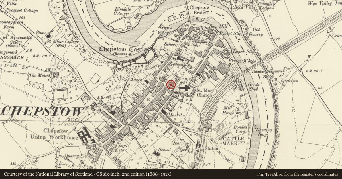
5 historical maps cover this location, the earliest the 1636 map "Cornubia : Devonia, Somersetus, Dorcestria, Wiltonia, Glocestria ..." (David Rumsey Map Collection, Stanford Libraries).
Historical maps covering this location
- 1636 · Cornubia : Devonia, Somersetus, Dorcestria, Wiltonia, Glocestria ... (David Rumsey Map Collection, Stanford Libraries)
- 1830 · V.3:11-15:XV.Britisches Reich. A. Kon: England. a. England ab sich: Shire:15-17, 33 (David Rumsey Map Collection, Stanford Libraries)
- 1895 · Sheet 11. Ordnance Survey of England and Wales. (David Rumsey Map Collection, Stanford Libraries)
- 1897 · 250 Chepstow (Outline) (David Rumsey Map Collection, Stanford Libraries)
- 1905 · 250 Chepstow (Hills) (David Rumsey Map Collection, Stanford Libraries)
Cadw's description
Location
In the centre of this range.
History
C18. List description of 1975 refers to modern ground floor windows so sashes are a reversion.
Exterior
Pair of Georgian houses, now incorporated into one restaurant. Left unit has pebbledash-rendered walls and machine tile roof with brick end stacks. Two storeys. Three-window range of 12-pane sashes; paired to ground floor right. Central doorway with C20 door. Attached and stepped down to right is a similar unit though ground floor is smooth rendered, 3-window range of sashes, 4-pane to first floor and multipane paired to ground floor either side of central doorway.
Reason for designation
Listed as a predominantly C18 group. Group value with other listed buildings in Upper Church Street.
Nearby in the register
- Griffin HouseDomesticunder 1 mi
- Plough HouseDomesticunder 1 mi
- 14 St Mary StreetCommercialunder 1 mi
- Sir Walter Montague AlmshousesHealth and Welfareunder 1 mi
Other entries of the same register within about three miles of this one, by straight line.