Cof Cymru: National Historic Assets of Wales · Wales
Church of St Sadwrnen
Laugharne Township, Carmarthenshire, Wales
A Grade II listed building in Llansadwrnen, Llanwrda, Laugharne Township, Carmarthenshire, designated on 2 November 2001.
The record
- Designation
- Listed building, Grade II
- Broad class
- Religious, Ritual and Funerary
- Date of designation
- 2 November 2001
- Locality
- Llansadwrnen
- Town
- Llanwrda
- Community
- Laugharne Township
- Unitary authority
- Carmarthenshire
- Country
- Wales
- Coordinates
- 51.76466, -4.49153
- Cadw reference
- 25849
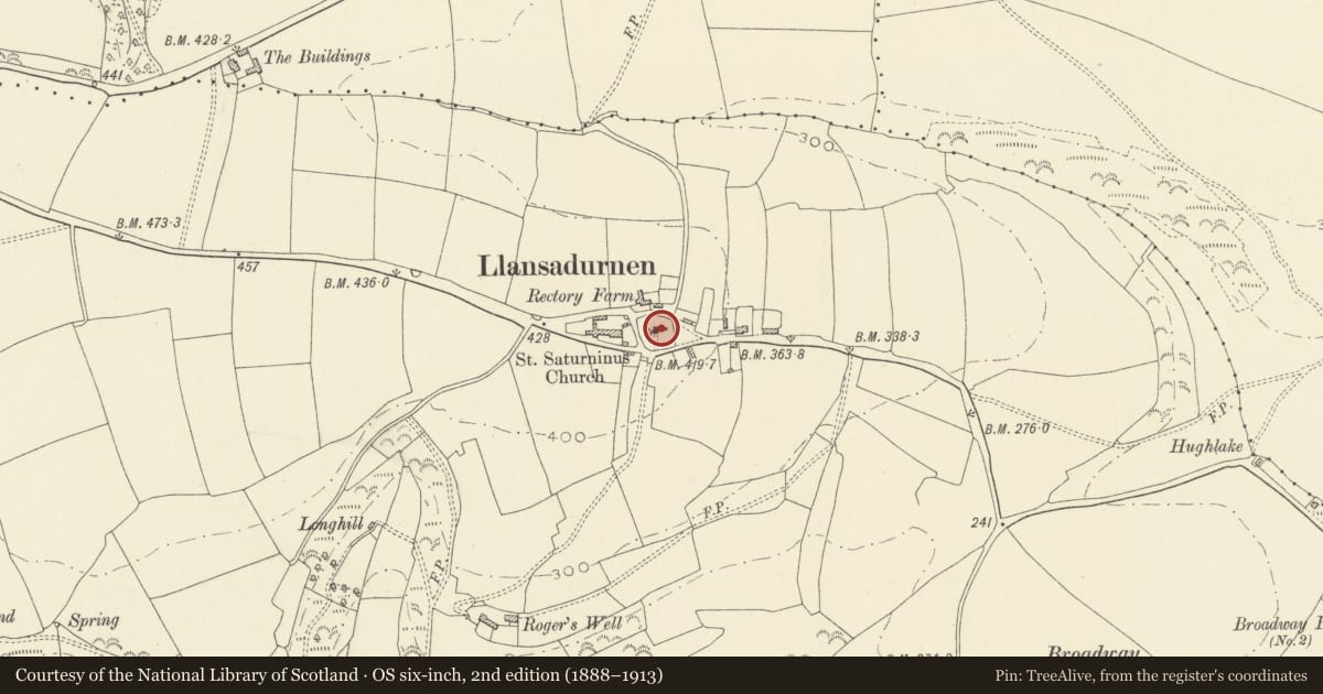
Slide toward Today to fade the historical sheet and see the modern map underneath.
David Rumsey Map Collection, Stanford LibrariesDavid Rumsey Map Collection, Stanford LibrariesDavid Rumsey Map Collection, Stanford LibrariesDavid Rumsey Map Collection, Stanford LibrariesDavid Rumsey Map Collection, Stanford Libraries
5 historical maps cover this location, the earliest the 1636 map "Cornubia : Devonia, Somersetus, Dorcestria, Wiltonia, Glocestria ..." (David Rumsey Map Collection, Stanford Libraries).
Historical maps covering this location
- 1636 · Cornubia : Devonia, Somersetus, Dorcestria, Wiltonia, Glocestria ... (David Rumsey Map Collection, Stanford Libraries)
- 1860 · 41. Caermathen. (David Rumsey Map Collection, Stanford Libraries)
- 1891 · Sheet 10. Ordnance Survey of England and Wales. . (David Rumsey Map Collection, Stanford Libraries)
- 1898 · 229 Carmarthen (Hills) (David Rumsey Map Collection, Stanford Libraries)
- 1920 · Sheet 100. Llanelly. (David Rumsey Map Collection, Stanford Libraries)
Cadw's description
Location
Prominently sited in historic churchyard high above Carmarthen Bay, about 2 km west of Laugharne.
History
Rebuilt in 1859, on site of its medieval predecessor, possibly retaining some core fabric of predecessor. North vestry added 1919.
Exterior
Church in Decorated Gothic Style. Red-brown stone with bathstone dressings, and relieving arches in blue-grey stone, stepped buttresses, slate roofs. Aisleless nave, chancel, SW tower, S porch, N vestry. Three bay nave with 2-light Decorated windows. South gabled porch which links (to L) with tower with steep pyramidal roof, parapet, single-light belfry windows; unusual round window with cusped tracery near ground level. Chancel with 3 single-light windows to N and S; 2-light E window. Three-light W window with quatrefoils in head. Lean-to vestry with prominent chimney on N side of nave.
Interior
Arch-braced roofs to nave and chancel; in E wall, medieval (C14?) niche with cinquefoiled ogee head and flanking pinnacles. The unusual round window low down in tower lights the old vestry which contains an Early Christian inscribed pillar-stone with inscription "TOTAVAL-/ FILIUS DOTHO/RANTI".
Reason for designation
C19 church retaining evidence of pre-Conquest and Medieval origins.
Nearby in the register
- Conservatory at Broadway MansionDomesticunder 1 mi
- PlashettDomesticunder 1 mi
- Parish Church of St OdoceusReligious, Ritual and Funeraryunder 1 mi
- LlandawkeDomesticunder 1 mi
Other entries of the same register within about three miles of this one, by straight line.