Cof Cymru: National Historic Assets of Wales · Wales
Llandawke
Laugharne Township, Carmarthenshire, Wales
A Grade II listed building in Laugharne Township, Carmarthenshire, designated on 21 November 1988.
The record
- Designation
- Listed building, Grade II
- Broad class
- Domestic
- Date of designation
- 21 November 1988
- Community
- Laugharne Township
- Unitary authority
- Carmarthenshire
- Country
- Wales
- Coordinates
- 51.77484, -4.49142
- Cadw reference
- 9684
Slide toward Today to fade the historical sheet and see the modern map underneath.
David Rumsey Map Collection, Stanford LibrariesDavid Rumsey Map Collection, Stanford LibrariesDavid Rumsey Map Collection, Stanford LibrariesDavid Rumsey Map Collection, Stanford LibrariesDavid Rumsey Map Collection, Stanford Libraries
5 historical maps cover this location, the earliest the 1636 map "Cornubia : Devonia, Somersetus, Dorcestria, Wiltonia, Glocestria ..." (David Rumsey Map Collection, Stanford Libraries).
Historical maps covering this location
- 1636 · Cornubia : Devonia, Somersetus, Dorcestria, Wiltonia, Glocestria ... (David Rumsey Map Collection, Stanford Libraries)
- 1860 · 41. Caermathen. (David Rumsey Map Collection, Stanford Libraries)
- 1891 · Sheet 10. Ordnance Survey of England and Wales. . (David Rumsey Map Collection, Stanford Libraries)
- 1898 · 229 Carmarthen (Hills) (David Rumsey Map Collection, Stanford Libraries)
- 1920 · Sheet 100. Llanelly. (David Rumsey Map Collection, Stanford Libraries)
Cadw's description
Location
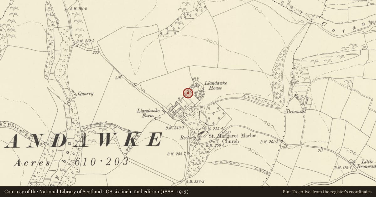
Situated on a hilltop to W of Laugharne reached by a farm track to N of the Parish Church.
History
Built in 1841 by Lord Kensington on the site of an older manor house. Bought by the local council in 1920's and converted into 2 properties.
Exterior
L-plan with late Georgian 2-storey modern cement render elevations (formerly stucco); plinth. Hipped slate roof, wide bracket eaves and cement render end chimney stacks. Recessed small pane horned sash windows; 16-pane to ground floor front. Central open pedimented doorcase with recessed half glazed door and traceried side and over lights; stone steps. 2-window side elevations, those windows towards front on right side are blocked; basement opening to left. 3-bay cement rendered and separately roofed extension at rear (No 2) with similar detail but shallower windows; gabled rear porch. There was formerly a further attached range demolished post war.
Interior
Interior retains 6-panel doors, panelled reveals and staircase with turned newel. Alterations in conversion.
Nearby in the register
- Parish Church of St OdoceusReligious, Ritual and Funeraryunder 1 mi
- Brixton FarmhouseDomesticunder 1 mi
- Cowhouse & Corn Store (including attached range to E.) at Brixton FarmAgriculture and Subsistenceunder 1 mi
- Horse engine House at Brixton FarmAgriculture and Subsistenceunder 1 mi
Other entries of the same register within about three miles of this one, by straight line.