Cof Cymru: National Historic Assets of Wales · Wales
Agricultural Range to N of Ciliau
Painscastle, Powys, Wales
A Grade II listed building in Llandeilo Graban, Painscastle, Powys, designated on 25 October 2001.
The record
- Designation
- Listed building, Grade II
- Broad class
- Agriculture and Subsistence
- Date of designation
- 25 October 2001
- Locality
- Llandeilo Graban
- Community
- Painscastle
- Unitary authority
- Powys
- Country
- Wales
- Coordinates
- 52.07796, -3.30274
- Cadw reference
- 25844
Slide toward Today to fade the historical sheet and see the modern map underneath.
David Rumsey Map Collection, Stanford LibrariesDavid Rumsey Map Collection, Stanford LibrariesDavid Rumsey Map Collection, Stanford LibrariesDavid Rumsey Map Collection, Stanford LibrariesDavid Rumsey Map Collection, Stanford Libraries
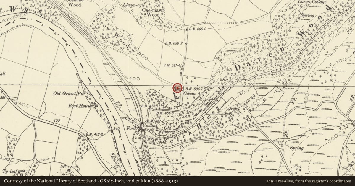
5 historical maps cover this location, the earliest the 1608 map "(13) Cambriae Typus." (David Rumsey Map Collection, Stanford Libraries).
Historical maps covering this location
- 1608 · (13) Cambriae Typus. (David Rumsey Map Collection, Stanford Libraries)
- 1637 · Particular description of Wales. Cambria seu Wallia (David Rumsey Map Collection, Stanford Libraries)
- 1856 · 42. Brecon. (David Rumsey Map Collection, Stanford Libraries)
- 1898 · 197 Hay (Hills) (David Rumsey Map Collection, Stanford Libraries)
- 1901 · Sheet 14. (David Rumsey Map Collection, Stanford Libraries)
Cadw's description
Location
Immediately to N of Ciliau, forming 2 sides of yard.
History
The greater part of the range is C18, possibly contemporary with work on the house in 1709; cart shed extension to E bears date 1816.
Exterior
L-plan range of agricultural buildings in stone; corrugated roof covering. Barn aligned E-W, and attached stable/cowshed range (N-S) to W. Barn has 2 large doorways facing S; ventilation slits. To R, later cartshed block (under restoration at time of inspection), 2 storeys, stone steps up to doorway, window to R, broad cart entrance to R of steps; window in gable end. Block at right angles has 2 windows at upper level; on ground floor, window, to L, and 4 doorways.
Interior
Barn of 7 bays, collar-and-tie-beam roof trusses, hipped roof at W end; 2 threshing floors. At E end of this range, later cartshed block. Boarded partition between barn and cowhouse/stable range of 6 bays with similar trusses.
Reason for designation
Substantial C18 agricultural range retaining its character. Group Value with Ciliau to S.
Nearby in the register
- CiliauDomesticunder 1 mi
- Barn/cowhouse block at Garth-fawrAgriculture and Subsistenceunder 1 mi
- Twyn y Garth GunCommemorativeunder 1 mi
- Twyn y Garth Round BarrowsRound Barrowunder 1 mi
Other entries of the same register within about three miles of this one, by straight line.