Cof Cymru: National Historic Assets of Wales · Wales
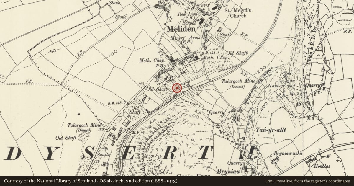
Retaining Wall of Meliden Railway Yard
Prestatyn, Denbighshire, Wales
A Grade II listed building in Meliden, Prestatyn, Denbighshire, designated on 12 September 2001.
The record
- Designation
- Listed building, Grade II
- Broad class
- Transport
- Date of designation
- 12 September 2001
- Locality
- Meliden
- Town
- Prestatyn
- Community
- Prestatyn
- Unitary authority
- Denbighshire
- Country
- Wales
- Coordinates
- 53.31496, -3.41088
- Cadw reference
- 25753
Slide toward Today to fade the historical sheet and see the modern map underneath.
David Rumsey Map Collection, Stanford LibrariesDavid Rumsey Map Collection, Stanford LibrariesDavid Rumsey Map Collection, Stanford LibrariesLlyfrgell Genedlaethol Cymru – The National Library of WalesNational Library of Scotland
5 historical maps cover this location, the earliest the 1795 map "To Sir Watkin Williams-Wynn Bart ... the map of the six counties of North Wales is most humbly inscribed by his obedient humble servant" (Llyfrgell Genedlaethol Cymru – The National Library of Wales).
Historical maps covering this location
- 1795 · To Sir Watkin Williams-Wynn Bart ... the map of the six counties of North Wales is most… (Llyfrgell Genedlaethol Cymru – The National Library of Wales)
- 1883 · Watershed map England, Wales 3. (David Rumsey Map Collection, Stanford Libraries)
- 1898 · 95 Rhyl (Hills) (David Rumsey Map Collection, Stanford Libraries)
- 1901 · Sheet 9 and 10. (David Rumsey Map Collection, Stanford Libraries)
- 1930 · OS Popular Edition 1919-1947 (National Library of Scotland)
Cadw's description
Location
On the west side of the yard of Meliden goods shed, facing Pen-y-maes.
History
Probably contemporary with the goods shed, c1869, and the opening of the Prestatyn - Dyserth line for freight traffic.
Exterior
A retaining and boundary wall in local axe-dressed limestone masonry informally coursed. The wall is about 4m high on the road side, battered at about 10 degrees from vertical. On the yard side the freestanding wall is about one and a half metres in height. Half-round sandstone coping.
The wall continues north to the boundary with adjacent property. The reduced height further continuation, fronting adjacent property, is not included in the listing.
Reason for designation
Listed for group value with the Meliden goods shed.
Nearby in the register
- Goods ShedTransportunder 1 mi
- Mountain AshDomesticunder 1 mi
- Lychgate at Church of St MelydReligious, Ritual and Funeraryunder 1 mi
- Church of St MelydReligious, Ritual and Funeraryunder 1 mi
Other entries of the same register within about three miles of this one, by straight line.