Cof Cymru: National Historic Assets of Wales · Wales
35 Moor Street
Chepstow, Monmouthshire, Wales
A Grade II listed building in Chepstow, Monmouthshire, designated on 24 March 1975.
The record
- Designation
- Listed building, Grade II
- Broad class
- Domestic
- Date of designation
- 24 March 1975
- Locality
- Chepstow
- Town
- Chepstow
- Community
- Chepstow
- Unitary authority
- Monmouthshire
- Country
- Wales
- Coordinates
- 51.64031, -2.67796
- Cadw reference
- 2567
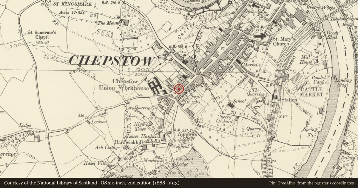
Slide toward Today to fade the historical sheet and see the modern map underneath.
David Rumsey Map Collection, Stanford LibrariesDavid Rumsey Map Collection, Stanford LibrariesDavid Rumsey Map Collection, Stanford LibrariesDavid Rumsey Map Collection, Stanford LibrariesDavid Rumsey Map Collection, Stanford Libraries
5 historical maps cover this location, the earliest the 1636 map "Cornubia : Devonia, Somersetus, Dorcestria, Wiltonia, Glocestria ..." (David Rumsey Map Collection, Stanford Libraries).
Historical maps covering this location
- 1636 · Cornubia : Devonia, Somersetus, Dorcestria, Wiltonia, Glocestria ... (David Rumsey Map Collection, Stanford Libraries)
- 1830 · V.3:11-15:XV.Britisches Reich. A. Kon: England. a. England ab sich: Shire:15-17, 33 (David Rumsey Map Collection, Stanford Libraries)
- 1895 · Sheet 11. Ordnance Survey of England and Wales. (David Rumsey Map Collection, Stanford Libraries)
- 1897 · 250 Chepstow (Outline) (David Rumsey Map Collection, Stanford Libraries)
- 1905 · 250 Chepstow (Hills) (David Rumsey Map Collection, Stanford Libraries)
Cadw's description
Location
Near the top of the street on the N side, the only listed building in this range.
History
Probably early C18.
Exterior
Small house now shop over both storeys. Walls rendered with roughcast; steep- pitched pantile roof with slightly swept eaves. Two storeys, two window range of 4-pane sashes with exposed frames. Ground floor has two splayed bay windows with multipane glazing, central recessed doorway.
Interior
Shop extends on balcony to first floor. One chamfered cross beam, small fireplace with chamfered beam, wattle panel exposed at first floor level.
Reason for designation
Listed as an early house in this range. Group value with the later Regency terrace opposite.
Nearby in the register
- 6 Moor StreetCommercialunder 1 mi
- 7 Moor StreetCommercialunder 1 mi
- 8 Moor StreetCommercialunder 1 mi
- 5 Moor StreetCommercialunder 1 mi
Other entries of the same register within about three miles of this one, by straight line.