Cof Cymru: National Historic Assets of Wales · Wales
Outbuilding at Nantyreglwys
Llanboidy, Carmarthenshire, Wales
A Grade II listed building in Nantyreglwys, Whitland, Llanboidy, Carmarthenshire, designated on 6 August 2001.
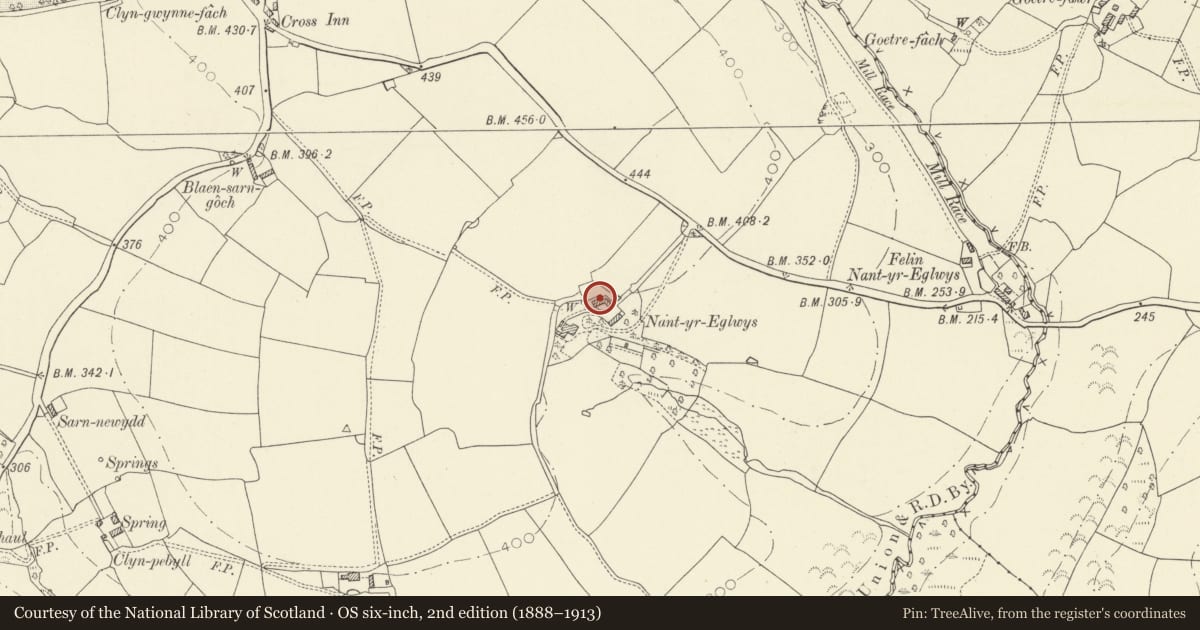
The record
- Designation
- Listed building, Grade II
- Broad class
- Agriculture and Subsistence
- Date of designation
- 6 August 2001
- Locality
- Nantyreglwys
- Town
- Whitland
- Community
- Llanboidy
- Unitary authority
- Carmarthenshire
- Country
- Wales
- Coordinates
- 51.86955, -4.55148
- Cadw reference
- 25645
Slide toward Today to fade the historical sheet and see the modern map underneath.
David Rumsey Map Collection, Stanford LibrariesDavid Rumsey Map Collection, Stanford LibrariesDavid Rumsey Map Collection, Stanford LibrariesDavid Rumsey Map Collection, Stanford LibrariesDavid Rumsey Map Collection, Stanford Libraries
5 historical maps cover this location, the earliest the 1608 map "(13) Cambriae Typus." (David Rumsey Map Collection, Stanford Libraries).
Historical maps covering this location
- 1608 · (13) Cambriae Typus. (David Rumsey Map Collection, Stanford Libraries)
- 1636 · Cornubia : Devonia, Somersetus, Dorcestria, Wiltonia, Glocestria ... (David Rumsey Map Collection, Stanford Libraries)
- 1830 · V.3:11-15:XV. Britisches Reich. A. Kon: England. b. Frstenthum Wales: Shire: 37-40 (David Rumsey Map Collection, Stanford Libraries)
- 1891 · Sheet 10. Ordnance Survey of England and Wales. . (David Rumsey Map Collection, Stanford Libraries)
- 1901 · Sheet 14. (David Rumsey Map Collection, Stanford Libraries)
Cadw's description
Location
Situated some 100m NE of Nantyreglwys mansion, set back on upper side of drive.
History
Coach-house and stable range to Nantyreglwys, probably earlier C19, but not marked on 1839 Tithe map.
Exterior
Outbuilding, whitewashed rubble stone with asbestos-sheet roof cladding. L-plan, partly lofted. At left depressed-arched cart-entry with sandstone voussoirs to arch. Rest of range has single row of brick dove-holes under eaves with slate shelf, interrupted at left by 2 small square loft lights. These are closely over 2 doors and then there is a third to right, a small window and finally an inserted door with red brick head, the others having single stone lintels. Short added range to right at right angles has depressed-arched cart-entry to left and then added whitewashed brick lean-to obscures front. Row of dove holes over lean-to . End has hipped roof and another depressed-arched cart-entry with brick arch.
Reason for designation
Included as a well-preserved coach house and stable range, a good example of a gentry estate outbuilding.
Nearby in the register
- NantyreglwysDomesticunder 1 mi
- MaencochDomesticunder 1 mi
- Rhydyceisiaid Independent Chapel with vestry and attached railings.Religious, Ritual and Funeraryunder 1 mi
- Hafod CampPromontory Fort - inland2 mi
Other entries of the same register within about three miles of this one, by straight line.