Cof Cymru: National Historic Assets of Wales · Wales
War Memorial
Llanfair Dyffryn Clwyd, Denbighshire, Wales
A Grade II listed building in Llanfair Dyffryn Clwyd, Denbighshire, designated on 19 May 2001.
The record
- Designation
- Listed building, Grade II
- Broad class
- Commemorative
- Date of designation
- 19 May 2001
- Locality
- Llanfair Dyffryn Clwyd
- Community
- Llanfair Dyffryn Clwyd
- Unitary authority
- Denbighshire
- Country
- Wales
- Coordinates
- 53.08893, -3.29440
- Cadw reference
- 25227
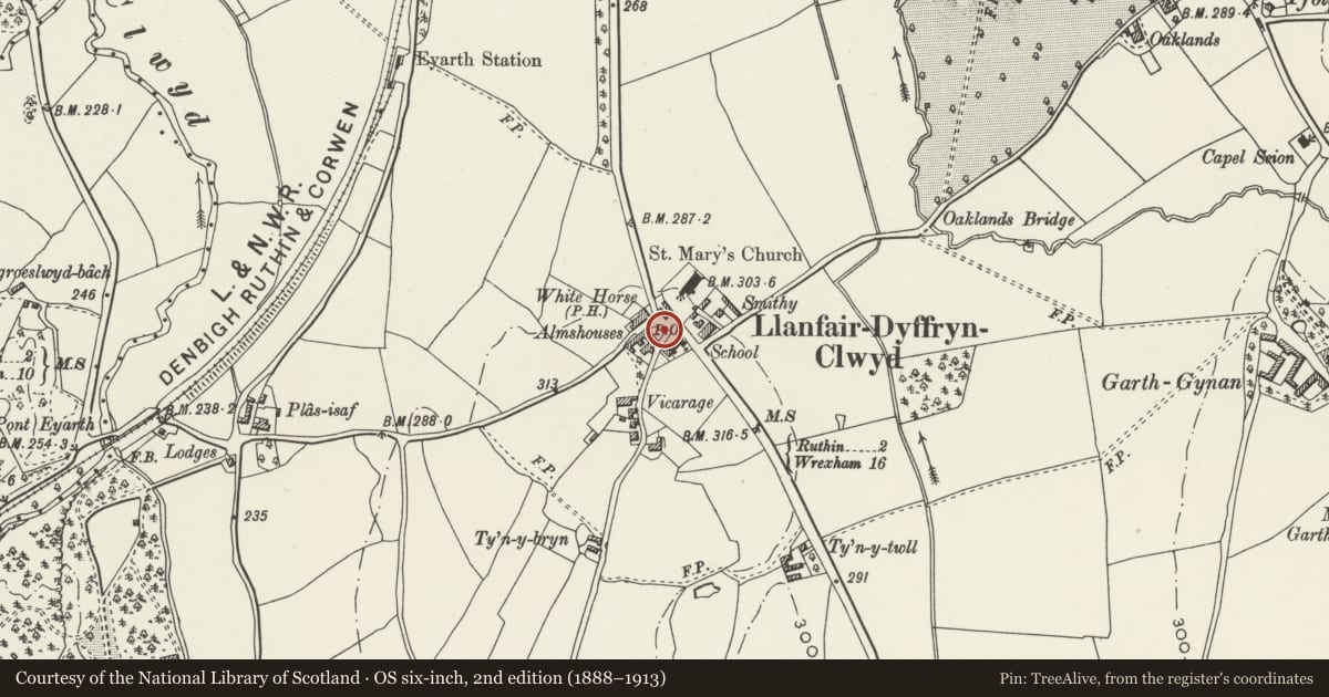
Slide toward Today to fade the historical sheet and see the modern map underneath.
David Rumsey Map Collection, Stanford LibrariesDavid Rumsey Map Collection, Stanford LibrariesLlyfrgell Genedlaethol Cymru – The National Library of WalesDavid Rumsey Map Collection, Stanford LibrariesDavid Rumsey Map Collection, Stanford Libraries
5 historical maps cover this location, the earliest the 1795 map "To Sir Watkin Williams-Wynn Bart ... the map of the six counties of North Wales is most humbly inscribed by his obedient humble servant" (Llyfrgell Genedlaethol Cymru – The National Library of Wales).
Historical maps covering this location
- 1795 · To Sir Watkin Williams-Wynn Bart ... the map of the six counties of North Wales is most… (Llyfrgell Genedlaethol Cymru – The National Library of Wales)
- 1830 · V.3:11-15:XV. Britisches Reich. A. Kon: England. b. Frstenthum Wales: Shire: 37-40 (David Rumsey Map Collection, Stanford Libraries)
- 1883 · Watershed map England, Wales 3. (David Rumsey Map Collection, Stanford Libraries)
- 1898 · 121 Wrexham (Hills) (David Rumsey Map Collection, Stanford Libraries)
- 1901 · Sheet 9 and 10. (David Rumsey Map Collection, Stanford Libraries)
Cadw's description
Location
In the centre of Llanfair Dyffryn Clwyd, in front of the Elizabeth Owen almshouses, in a low-walled paved area.
History
A war memorial commemorating the fallen in the Great War with additional stones to record the names of the fallen in the Second World War.
Exterior
Memorial in the form of a tapering white granite monolith, square in plan, on two steps. The top is slightly reduced in size. The front of the stone faces east, and has a raised cross above an inscribed sunk panel. The names are recorded on sunk panels to the sides. Additional stones at foot record the names added after the Second World War.
Reason for designation
Included for group value with the other listed buildings in the centre of Llanfair Dyffryn Clwyd.
Nearby in the register
- Nos.1-8 Elizabeth Owen Charity AlmshousesHealth and Welfareunder 1 mi
- Ceffyl Gwyn Public HouseCommercialunder 1 mi
- Llanfair Dyffryn Clwyd Controlled SchoolEducationunder 1 mi
- Lychgate at St Cynfarch and St Mary's ChurchReligious, Ritual and Funeraryunder 1 mi
Other entries of the same register within about three miles of this one, by straight line.