Cof Cymru: National Historic Assets of Wales · Wales
Stables at Garthgynan
Llanfair Dyffryn Clwyd, Denbighshire, Wales
A Grade II* listed building in Llanfair Dyffryn Clwyd, Denbighshire, designated on 19 May 2001.
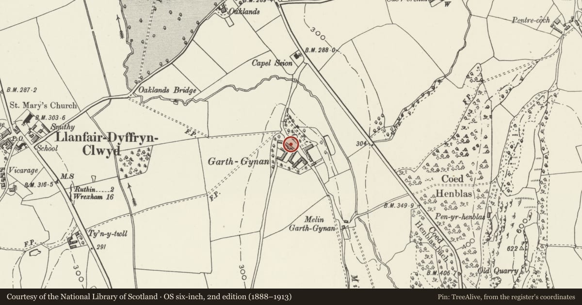
The record
- Designation
- Listed building, Grade II*
- Broad class
- Agriculture and Subsistence
- Date of designation
- 19 May 2001
- Locality
- Llanfair Dyffryn Clwyd
- Community
- Llanfair Dyffryn Clwyd
- Unitary authority
- Denbighshire
- Country
- Wales
- Coordinates
- 53.08878, -3.28225
- Cadw reference
- 25216
Slide toward Today to fade the historical sheet and see the modern map underneath.
David Rumsey Map Collection, Stanford LibrariesDavid Rumsey Map Collection, Stanford LibrariesLlyfrgell Genedlaethol Cymru – The National Library of WalesDavid Rumsey Map Collection, Stanford LibrariesDavid Rumsey Map Collection, Stanford Libraries
5 historical maps cover this location, the earliest the 1795 map "To Sir Watkin Williams-Wynn Bart ... the map of the six counties of North Wales is most humbly inscribed by his obedient humble servant" (Llyfrgell Genedlaethol Cymru – The National Library of Wales).
Historical maps covering this location
- 1795 · To Sir Watkin Williams-Wynn Bart ... the map of the six counties of North Wales is most… (Llyfrgell Genedlaethol Cymru – The National Library of Wales)
- 1830 · V.3:11-15:XV. Britisches Reich. A. Kon: England. b. Frstenthum Wales: Shire: 37-40 (David Rumsey Map Collection, Stanford Libraries)
- 1883 · Watershed map England, Wales 3. (David Rumsey Map Collection, Stanford Libraries)
- 1898 · 121 Wrexham (Hills) (David Rumsey Map Collection, Stanford Libraries)
- 1901 · Sheet 9 and 10. (David Rumsey Map Collection, Stanford Libraries)
Cadw's description
Location
West of Garthgynan farmhouse, across farm track.
History
The stable carries a datestone marked I / W W / 1698.
Exterior
A symmetrically fronted stable building started in limestone, but changing at about 2 metres height to brickwork. The stone is local limestone rubble and the brickwork is in English Garden Wall bond. Slate roof. Central doorway in dressed limestone with a flat-arch including a keystone. The windows each side are square, with similar flat arches. The loft openings above are shuttered. The datestone is centrally above the door. A brickwork lean-to with synthetic slate roof occupies the right half of the rear elevation.
Interior
The interior retains its feeding racks against the rear wall and the chutes from the hayloft. It was formerly laid out as six stalls but is now three loose boxes. Tack room at rear.
Reason for designation
Listed for group value with Garthgynan farmhouse and with other listed buildings of the grounds and farmyard.
Nearby in the register
- Detached Shelter Shed at GarthgynanAgriculture and Subsistenceunder 1 mi
- Granary at GarthgynanAgriculture and Subsistenceunder 1 mi
- Cowshed and Calfshed Ranges around Midden at GarthgynanAgriculture and Subsistenceunder 1 mi
- Cottage and Brewhouse at GarthgynanAgriculture and Subsistenceunder 1 mi
Other entries of the same register within about three miles of this one, by straight line.