Cof Cymru: National Historic Assets of Wales · Wales
Cottage and Brewhouse at Garthgynan
Llanfair Dyffryn Clwyd, Denbighshire, Wales
A Grade II listed building in Llanfair Dyffryn Clwyd, Denbighshire, designated on 19 May 2001.
The record
- Designation
- Listed building, Grade II
- Broad class
- Agriculture and Subsistence
- Date of designation
- 19 May 2001
- Locality
- Llanfair Dyffryn Clwyd
- Community
- Llanfair Dyffryn Clwyd
- Unitary authority
- Denbighshire
- Country
- Wales
- Coordinates
- 53.08855, -3.28138
- Cadw reference
- 25210
Slide toward Today to fade the historical sheet and see the modern map underneath.
David Rumsey Map Collection, Stanford LibrariesDavid Rumsey Map Collection, Stanford LibrariesLlyfrgell Genedlaethol Cymru – The National Library of WalesDavid Rumsey Map Collection, Stanford LibrariesDavid Rumsey Map Collection, Stanford Libraries
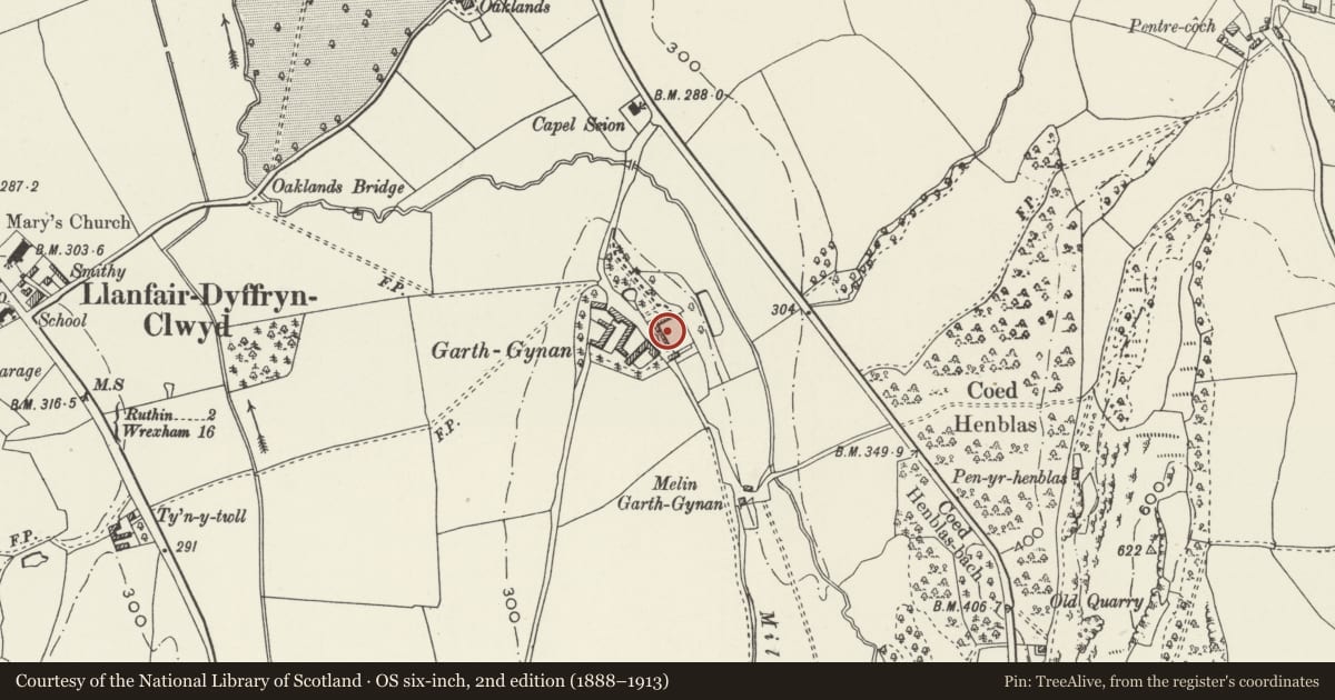
5 historical maps cover this location, the earliest the 1795 map "To Sir Watkin Williams-Wynn Bart ... the map of the six counties of North Wales is most humbly inscribed by his obedient humble servant" (Llyfrgell Genedlaethol Cymru – The National Library of Wales).
Historical maps covering this location
- 1795 · To Sir Watkin Williams-Wynn Bart ... the map of the six counties of North Wales is most… (Llyfrgell Genedlaethol Cymru – The National Library of Wales)
- 1830 · V.3:11-15:XV. Britisches Reich. A. Kon: England. b. Frstenthum Wales: Shire: 37-40 (David Rumsey Map Collection, Stanford Libraries)
- 1883 · Watershed map England, Wales 3. (David Rumsey Map Collection, Stanford Libraries)
- 1898 · 121 Wrexham (Hills) (David Rumsey Map Collection, Stanford Libraries)
- 1901 · Sheet 9 and 10. (David Rumsey Map Collection, Stanford Libraries)
Cadw's description
Location
Immediately west of Garthgynan farmhouse
History
Probably C19, but with a datestone of 1658. The building is now a storeroom.
Exterior
A building in local limestone rubble masonry, with a central shared chimney stack slightly off-centre. Slate roof with tile ridge. Pairs of six-pane casements above and below. Base only of central chimney stack. The right unit is a cottage and has its door at front, the left unit resembles a cottage and was possibly altered from one but was more probably a brewhouse from the start; it has a door in the left gable wall leading to stairs to the loft, and another to the ground storey interior.
At high level on the front is a prominent datestone, marked 1658 WW, probably ex situ.
Interior
The left unit contains the hearth and equipment of a brewhouse, and a separately entered loft above; the right unit contains a domestic hearth.
Reason for designation
Listed for group value with Garthgynan farmhouse and with other listed buildings of the grounds and farmyard.
Nearby in the register
- Smithy at GarthgynanAgriculture and Subsistenceunder 1 mi
- GarthgynanDomesticunder 1 mi
- Garden Walls with Privy, Pavilion and Cottage at GarthgynanAgriculture and Subsistenceunder 1 mi
- Cartsheds with Loft at GarthgynanAgriculture and Subsistenceunder 1 mi
Other entries of the same register within about three miles of this one, by straight line.