Cof Cymru: National Historic Assets of Wales · Wales
Smithy at Garthgynan
Llanfair Dyffryn Clwyd, Denbighshire, Wales
A Grade II listed building in Llanfair Dyffryn Clwyd, Denbighshire, designated on 19 May 2001.
The record
- Designation
- Listed building, Grade II
- Broad class
- Agriculture and Subsistence
- Date of designation
- 19 May 2001
- Locality
- Llanfair Dyffryn Clwyd
- Community
- Llanfair Dyffryn Clwyd
- Unitary authority
- Denbighshire
- Country
- Wales
- Coordinates
- 53.08843, -3.28128
- Cadw reference
- 25212
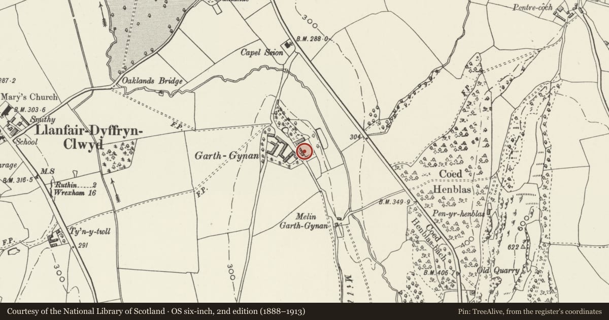
Slide toward Today to fade the historical sheet and see the modern map underneath.
David Rumsey Map Collection, Stanford LibrariesDavid Rumsey Map Collection, Stanford LibrariesLlyfrgell Genedlaethol Cymru – The National Library of WalesDavid Rumsey Map Collection, Stanford LibrariesDavid Rumsey Map Collection, Stanford Libraries
5 historical maps cover this location, the earliest the 1795 map "To Sir Watkin Williams-Wynn Bart ... the map of the six counties of North Wales is most humbly inscribed by his obedient humble servant" (Llyfrgell Genedlaethol Cymru – The National Library of Wales).
Historical maps covering this location
- 1795 · To Sir Watkin Williams-Wynn Bart ... the map of the six counties of North Wales is most… (Llyfrgell Genedlaethol Cymru – The National Library of Wales)
- 1830 · V.3:11-15:XV. Britisches Reich. A. Kon: England. b. Frstenthum Wales: Shire: 37-40 (David Rumsey Map Collection, Stanford Libraries)
- 1883 · Watershed map England, Wales 3. (David Rumsey Map Collection, Stanford Libraries)
- 1898 · 121 Wrexham (Hills) (David Rumsey Map Collection, Stanford Libraries)
- 1901 · Sheet 9 and 10. (David Rumsey Map Collection, Stanford Libraries)
Cadw's description
Location
At west side of the walled garden of Garthgynan farmhouse.
History
Probably an C18 workshop. The east gable wall is in brickwork, built off the brickwork of the walled garden. This was originally a single room workshop, but was divided into two by the insertion of a wall separating the smithy (to east) from a general workshop (at west). The smithy equipment is perhaps C19, the flue from the smith's hearth blocking the original ventilation hole in the east gable.
Exterior
A blacksmith's workshop, the east wall incorporating brickwork of the adjacent walled garden and heightened in brickwork; the other walls in local limestone rubble masonry. Slate roof with tile ridge. Large circular original ventilator in the apex of the east gable; two small ventilation apertures in the west gable. The main door in the west gable is ledged and boarded.
Interior
Fully equipped C19 or early C20 smithy with bellows, hearth, anvil and workbenches.
Reason for designation
A fully surviving smithy, listed also for group value with Garthgynan farmhouse and with other listed buildings of the grounds and farmyard.
Nearby in the register
- Cottage and Brewhouse at GarthgynanAgriculture and Subsistenceunder 1 mi
- Garden Walls with Privy, Pavilion and Cottage at GarthgynanAgriculture and Subsistenceunder 1 mi
- Cartsheds with Loft at GarthgynanAgriculture and Subsistenceunder 1 mi
- GarthgynanDomesticunder 1 mi
Other entries of the same register within about three miles of this one, by straight line.