Cof Cymru: National Historic Assets of Wales · Wales
Pant-y-cryntach
Mechell, Isle of Anglesey, Wales
A Grade II listed building in Carreglefn, Amlwch, Mechell, Isle of Anglesey, designated on 2 May 2001.
The record
- Designation
- Listed building, Grade II
- Broad class
- Domestic
- Date of designation
- 2 May 2001
- Locality
- Carreglefn
- Town
- Amlwch
- Community
- Mechell
- Unitary authority
- Isle of Anglesey
- Country
- Wales
- Coordinates
- 53.37940, -4.42610
- Cadw reference
- 25166
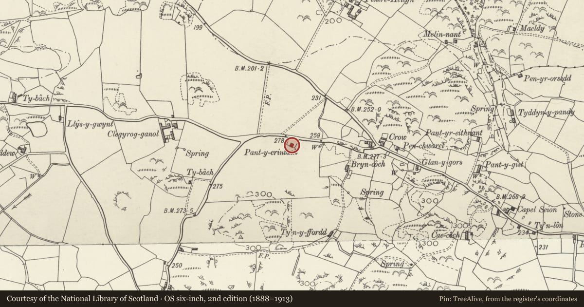
Slide toward Today to fade the historical sheet and see the modern map underneath.
David Rumsey Map Collection, Stanford LibrariesDavid Rumsey Map Collection, Stanford LibrariesDavid Rumsey Map Collection, Stanford LibrariesDavid Rumsey Map Collection, Stanford LibrariesDavid Rumsey Map Collection, Stanford Libraries
5 historical maps cover this location, the earliest the 1883 map "Watershed map England, Wales 3." (David Rumsey Map Collection, Stanford Libraries).
Historical maps covering this location
- 1883 · Watershed map England, Wales 3. (David Rumsey Map Collection, Stanford Libraries)
- 1896 · Sheet 7. Ordnance Survey of England and Wales. (David Rumsey Map Collection, Stanford Libraries)
- 1899 · 93 Holyhead (Hills) (David Rumsey Map Collection, Stanford Libraries)
- 1901 · Sheet 9 and 10. (David Rumsey Map Collection, Stanford Libraries)
- 1919 · Sheet 41. Anglesey. (David Rumsey Map Collection, Stanford Libraries)
Cadw's description
Location
Set back from the S side of a country road c600m NE of the village of Carreglefn.
History
Late C18 or early C19 cottage. There are no cottages marked on the Tithe Map of the parish of Llanbadrig, 1844; the land on which it stands part of the farmstead of Clegyrog Ganol, owned by Owen Thomas Bulkeley Esq.
Exterior
Single storey vernacular cottage with lean-to abutting the NE corner. Built of local stone, limewashed; modern slate roof with stone coping and rectangular gable stacks with capping. The entrance elevation faces SE, central doorway with flanking windows with slate sills; the door is a modern boarded door and the windows 4-pane replacement casements. The lean-to has a profiled roof of modern material and a single doorway to front (SE).
Interior
Interior not inspected at the time of the survey.
Reason for designation
Listed as a late C18 or early C19 cottage which, notwithstanding modernisation, retains its vernacular character.
Nearby in the register
- Cottage at Pant-y-GistDomesticunder 1 mi
- Ty NewyddDomesticunder 1 mi
- Hen BontDomesticunder 1 mi
- Y StrydDomesticunder 1 mi
Other entries of the same register within about three miles of this one, by straight line.