Cof Cymru: National Historic Assets of Wales · Wales
Lofted cartshed on W side of yard at Camrose Home Farm
Camrose, Pembrokeshire, Wales
A Grade II listed building in Camrose, Haverfordwest, Pembrokeshire, designated on 30 April 2001.
The record
- Designation
- Listed building, Grade II
- Broad class
- Agriculture and Subsistence
- Date of designation
- 30 April 2001
- Locality
- Camrose
- Town
- Haverfordwest
- Community
- Camrose
- Unitary authority
- Pembrokeshire
- Country
- Wales
- Coordinates
- 51.83509, -5.00343
- Cadw reference
- 25161
Slide toward Today to fade the historical sheet and see the modern map underneath.
David Rumsey Map Collection, Stanford LibrariesDavid Rumsey Map Collection, Stanford LibrariesDavid Rumsey Map Collection, Stanford LibrariesDavid Rumsey Map Collection, Stanford LibrariesDavid Rumsey Map Collection, Stanford Libraries
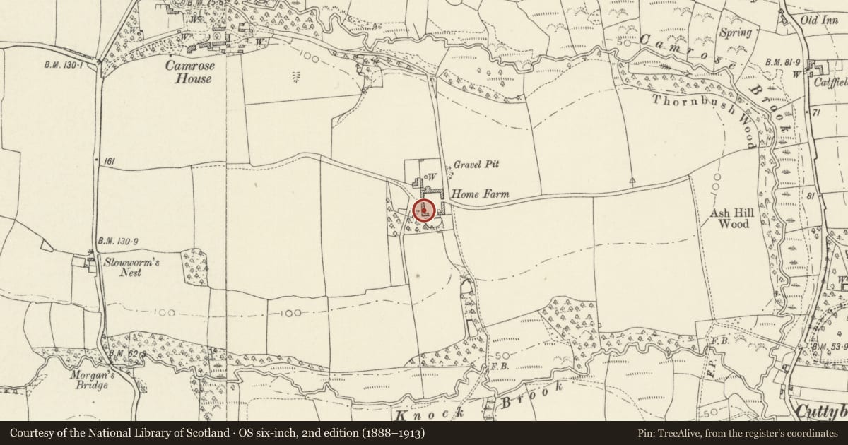
5 historical maps cover this location, the earliest the 1608 map "(13) Cambriae Typus." (David Rumsey Map Collection, Stanford Libraries).
Historical maps covering this location
- 1608 · (13) Cambriae Typus. (David Rumsey Map Collection, Stanford Libraries)
- 1636 · Cornubia : Devonia, Somersetus, Dorcestria, Wiltonia, Glocestria ... (David Rumsey Map Collection, Stanford Libraries)
- 1891 · Sheet 10. Ordnance Survey of England and Wales. . (David Rumsey Map Collection, Stanford Libraries)
- 1898 · 228 Haverfordwest (Hills) (David Rumsey Map Collection, Stanford Libraries)
- 1901 · Sheet 13. (David Rumsey Map Collection, Stanford Libraries)
Cadw's description
Location
Situated at SW corner of farm court at Camrose Home Farm.
History
Late C18 or earlier C19 lofted cart-shed marked on the Camrose Tithe map of 1839.
Exterior
Lofted cartshed, rubble stone with hipped grouted slate roof with 2 square loft openings with brick cambered heads and 3 cambered arched cart-entries below with cut stone voussoirs and keystones. Outside steps in N end wall to loft door. Rear has 2 small square loft lights.
Attached to left is an L-plan single storey range, much altered with corrugated iron and grouted slate roofs, all the openings altered in C20. Range S of main building has blocked door to centre and broad opening to left, range facing N has long opening to right and blocked entry left.
Reason for designation
Included as a formal two-storey cart-shed with granary over, part of the extensive model farm at Camrose.
Nearby in the register
- Single storey outbuilding on W side of yard at Camrose Home FarmAgriculture and Subsistenceunder 1 mi
- Lofted outbuilding, wings and gin-house at Camrose Home FarmAgriculture and Subsistenceunder 1 mi
- Camrose Home FarmhouseDomesticunder 1 mi
- Coach-house at Camrose HouseDomesticunder 1 mi
Other entries of the same register within about three miles of this one, by straight line.