Cof Cymru: National Historic Assets of Wales · Wales
Signpost Penalt/Trelleck
Trellech United, Monmouthshire, Wales
A Grade II listed building in Whitebrook, Monmouth, Trellech United, Monmouthshire, designated on 28 February 2001.
The record
- Designation
- Listed building, Grade II
- Broad class
- Transport
- Date of designation
- 28 February 2001
- Locality
- Whitebrook
- Town
- Monmouth
- Community
- Trellech United
- Unitary authority
- Monmouthshire
- Country
- Wales
- Coordinates
- 51.76372, -2.71043
- Cadw reference
- 24944
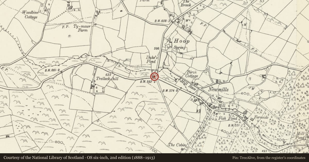
Slide toward Today to fade the historical sheet and see the modern map underneath.
David Rumsey Map Collection, Stanford LibrariesDavid Rumsey Map Collection, Stanford LibrariesDavid Rumsey Map Collection, Stanford LibrariesDavid Rumsey Map Collection, Stanford LibrariesDavid Rumsey Map Collection, Stanford Libraries
5 historical maps cover this location, the earliest the 1636 map "Cornubia : Devonia, Somersetus, Dorcestria, Wiltonia, Glocestria ..." (David Rumsey Map Collection, Stanford Libraries).
Historical maps covering this location
- 1636 · Cornubia : Devonia, Somersetus, Dorcestria, Wiltonia, Glocestria ... (David Rumsey Map Collection, Stanford Libraries)
- 1637 · The fourth table of England. Cornub. Devonia, Somerset etc. (David Rumsey Map Collection, Stanford Libraries)
- 1830 · V.3:11-15:XV.Britisches Reich. A. Kon: England. a. England ab sich: Shire:15-17, 33 (David Rumsey Map Collection, Stanford Libraries)
- 1895 · Sheet 11. Ordnance Survey of England and Wales. (David Rumsey Map Collection, Stanford Libraries)
- 1896 · 233 Monmouth (Hills) (David Rumsey Map Collection, Stanford Libraries)
Cadw's description
Location
On the south side of the Whitebrook valley road and about 2500m west of the Church of the Holy Trinity. It is at the crossroads for Whitebrook, Penallt, Monmouth and The Narth.
History
A Monmouthshire County Council signpost of the type erected following the County Councils taking over responsibility for roads after the 1888 County Councils Act. It was probably erected in the early C20.
Exterior
Cast iron sign post with four arms. The post is a fluted Doric column which supports two arms with raised lettering PENALT 2 I/2 and NARTH 1 TRELLECK 3. Above these are two more WHITEBROOK 1 3/4 and MONMOUTH 5. The post is topped by a vertical ring inscribed MONMOUTHSHIRE COUNTY COUNCIL.
Reason for designation
Included as an unaltered probably early C20 Monmouthshire County Council signpost. Now extremely rare in unaltered state.
Nearby in the register
- Fernside MillIndustrialunder 1 mi
- High GlanauDomesticunder 1 mi
- Gardener's Cottage at High GlanauDomesticunder 1 mi
- Garage at High GlanauDomesticunder 1 mi
Other entries of the same register within about three miles of this one, by straight line.