Cof Cymru: National Historic Assets of Wales · Wales
The Old Post Office
Raglan, Monmouthshire, Wales
A Grade II listed building in Raglan, Monmouthshire, designated on 31 January 2001.
The record
- Designation
- Listed building, Grade II
- Broad class
- Domestic
- Date of designation
- 31 January 2001
- Locality
- Raglan
- Town
- Raglan
- Community
- Raglan
- Unitary authority
- Monmouthshire
- Country
- Wales
- Coordinates
- 51.76552, -2.85157
- Cadw reference
- 24730
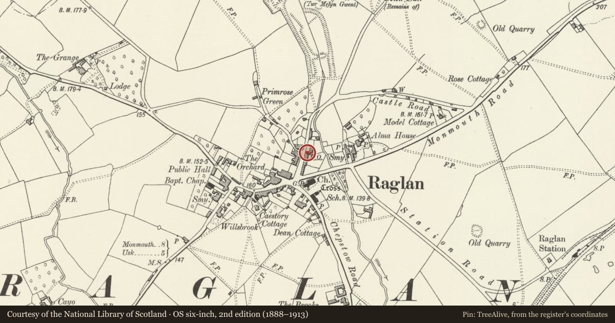
Slide toward Today to fade the historical sheet and see the modern map underneath.
David Rumsey Map Collection, Stanford LibrariesDavid Rumsey Map Collection, Stanford LibrariesDavid Rumsey Map Collection, Stanford LibrariesDavid Rumsey Map Collection, Stanford LibrariesDavid Rumsey Map Collection, Stanford Libraries
5 historical maps cover this location, the earliest the 1636 map "Cornubia : Devonia, Somersetus, Dorcestria, Wiltonia, Glocestria ..." (David Rumsey Map Collection, Stanford Libraries).
Historical maps covering this location
- 1636 · Cornubia : Devonia, Somersetus, Dorcestria, Wiltonia, Glocestria ... (David Rumsey Map Collection, Stanford Libraries)
- 1830 · V.3:11-15:XV.Britisches Reich. A. Kon: England. a. England ab sich: Shire:15-17, 33 (David Rumsey Map Collection, Stanford Libraries)
- 1895 · Sheet 11. Ordnance Survey of England and Wales. (David Rumsey Map Collection, Stanford Libraries)
- 1896 · 233 Monmouth (Hills) (David Rumsey Map Collection, Stanford Libraries)
- 1913 · Sheet 102. Newport. (David Rumsey Map Collection, Stanford Libraries)
Cadw's description
Location
Castle Street runs N from Beaufort Square in Raglan towards the castle. No 9 on the E side is part of a single range with No 8.
History
Earlier to Mid C19. No 9 was originally the service range of No 8 Castle St, the double-fronted house to the right. When divided, the service wing and one bay of the main house became No 9, used as the Post Office before being transferred to Raglan House, High Street.
Exterior
House, white-painted stucco with slate close-eaved roof and painted red brick end stacks, that to right shared with No 8, of which this was formerly the service range. Quoins to left, matching those on right end of No 8. Two storeys, one-window range of 12-pane sash windows, the ground floor sash cambered-headed and slightly smaller than the one above. C20 6 panel door to right. House also includes right bay of main house (No 8) with canted bay-window and 12-pane hornless sash.
Interior
Interior not available for inspection at time of resurvey (December 1999)
Reason for designation
Included for group value with 8 Castle Street, of which it forms a single build. Part of a substantial earlier to mid C19 town house retaining original character.
Nearby in the register
- 8 Castle StreetDomesticunder 1 mi
- 7 Castle StreetDomesticunder 1 mi
- The Malt HouseDomesticunder 1 mi
- Exmoor HouseDomesticunder 1 mi
Other entries of the same register within about three miles of this one, by straight line.