Cof Cymru: National Historic Assets of Wales · Wales
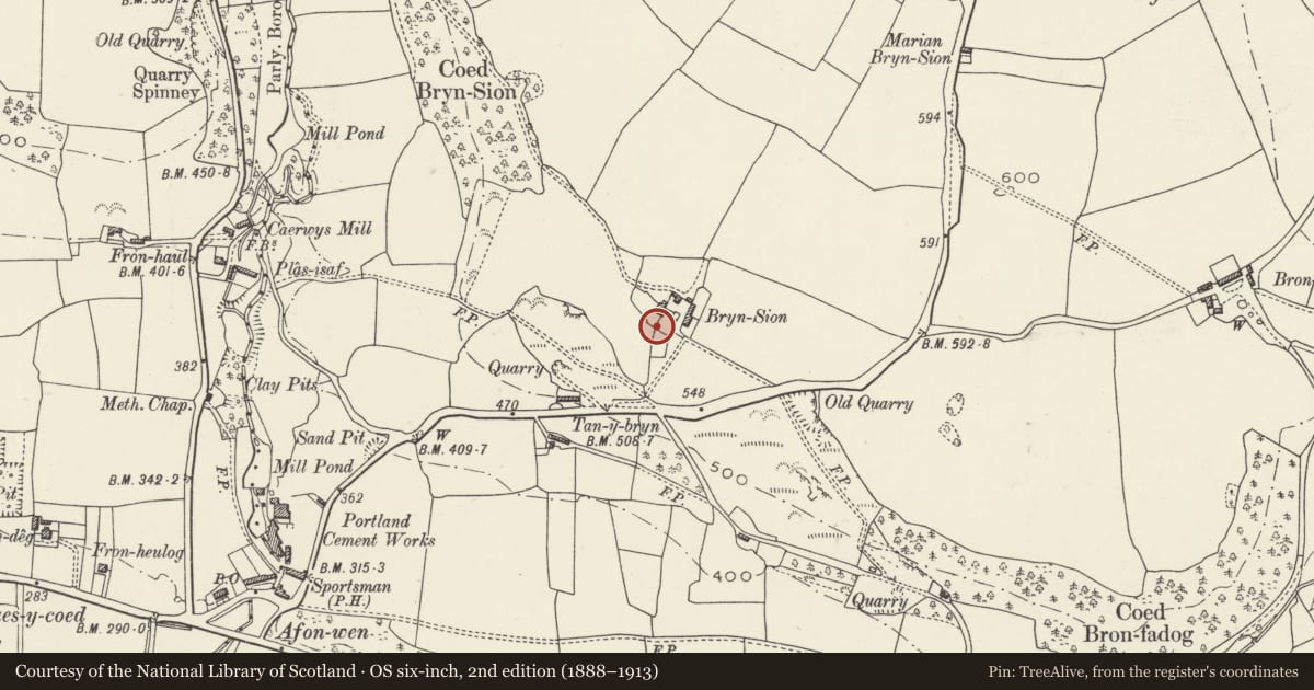
Gatehouse with attached garden walls at Bryn Sion
Ysceifiog, Flintshire, Wales
A Grade II listed building in Afonwen, Ysceifiog, Flintshire, designated on 31 January 2001.
The record
- Designation
- Listed building, Grade II
- Broad class
- Gardens, Parks and Urban Spaces
- Date of designation
- 31 January 2001
- Locality
- Afonwen
- Community
- Ysceifiog
- Unitary authority
- Flintshire
- Country
- Wales
- Coordinates
- 53.23758, -3.29519
- Cadw reference
- 24673
Slide toward Today to fade the historical sheet and see the modern map underneath.
David Rumsey Map Collection, Stanford LibrariesDavid Rumsey Map Collection, Stanford LibrariesDavid Rumsey Map Collection, Stanford LibrariesDavid Rumsey Map Collection, Stanford LibrariesLlyfrgell Genedlaethol Cymru – The National Library of Wales
5 historical maps cover this location, the earliest the 1795 map "To Sir Watkin Williams-Wynn Bart ... the map of the six counties of North Wales is most humbly inscribed by his obedient humble servant" (Llyfrgell Genedlaethol Cymru – The National Library of Wales).
Historical maps covering this location
- 1795 · To Sir Watkin Williams-Wynn Bart ... the map of the six counties of North Wales is most… (Llyfrgell Genedlaethol Cymru – The National Library of Wales)
- 1883 · Watershed map England, Wales 3. (David Rumsey Map Collection, Stanford Libraries)
- 1898 · 108 Flint (Hills) (David Rumsey Map Collection, Stanford Libraries)
- 1898 · 108 Flint (Outline) (David Rumsey Map Collection, Stanford Libraries)
- 1901 · Sheet 9 and 10. (David Rumsey Map Collection, Stanford Libraries)
Cadw's description
Location
On the SE side of the house.
History
The garden walls are shown on the 1849 Tithe map, while the gatehouse was probably built as an ornamental feature in the third quarter of the C19 and is shown on the 1871 Ordnance Survey.
Exterior
Rubble-stone walls enclosing a garden on the E (front) and extending to the SE side of the house. A gateway of 2-storey height, of rubble stone and slate roof is added to the S wall. Its outer side has a renewed timber lintel. On the inner side the wide opening has been narrowed with rubble infill. In the E gable end is a small upper-storey vent, while on the W side is an added rubble-stone lean-to shed wrapped around the outer angle.
Reason for designation
Listed for group value with Bryn Sion.
Nearby in the register
- Bryn SionDomesticunder 1 mi
- Bron Fadog EnclosureEnclosureunder 1 mi
- Row of kilns at former Afon Wen Portland Cement WorksIndustrialunder 1 mi
- Bron FadogDomesticunder 1 mi
Other entries of the same register within about three miles of this one, by straight line.