Cof Cymru: National Historic Assets of Wales · Wales
Row of kilns at former Afon Wen Portland Cement Works
Caerwys, Flintshire, Wales
A Grade II listed building in Afonwen, Caerwys, Flintshire, designated on 19 July 2002.
The record
- Designation
- Listed building, Grade II
- Broad class
- Industrial
- Date of designation
- 19 July 2002
- Locality
- Afonwen
- Community
- Caerwys
- Unitary authority
- Flintshire
- Country
- Wales
- Coordinates
- 53.23521, -3.30249
- Cadw reference
- 26776
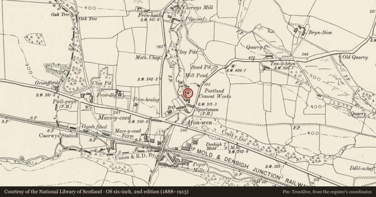
Slide toward Today to fade the historical sheet and see the modern map underneath.
David Rumsey Map Collection, Stanford LibrariesDavid Rumsey Map Collection, Stanford LibrariesDavid Rumsey Map Collection, Stanford LibrariesDavid Rumsey Map Collection, Stanford LibrariesLlyfrgell Genedlaethol Cymru – The National Library of Wales
5 historical maps cover this location, the earliest the 1795 map "To Sir Watkin Williams-Wynn Bart ... the map of the six counties of North Wales is most humbly inscribed by his obedient humble servant" (Llyfrgell Genedlaethol Cymru – The National Library of Wales).
Historical maps covering this location
- 1795 · To Sir Watkin Williams-Wynn Bart ... the map of the six counties of North Wales is most… (Llyfrgell Genedlaethol Cymru – The National Library of Wales)
- 1883 · Watershed map England, Wales 3. (David Rumsey Map Collection, Stanford Libraries)
- 1898 · 108 Flint (Hills) (David Rumsey Map Collection, Stanford Libraries)
- 1898 · 108 Flint (Outline) (David Rumsey Map Collection, Stanford Libraries)
- 1901 · Sheet 9 and 10. (David Rumsey Map Collection, Stanford Libraries)
Cadw's description
Location
Approximately 180m NE of the junction of the A541 and B5122 and on the E side of Heron's Retreat Holiday Park.
History
Built in the early C20 as part of the Afonwen Portland Cement Works, which was built in the final quarter of the C19 on the site of a paper works shown on the 1871 Ordnance Survey. The kilns were used for firing a mixture of lime and clay at high temperature.
Exterior
A bank of 10 former kilns built into a steep bank. At the lower level is a battered wall with segmental-headed draw arches of varying heights, and impost band (except to the 3 R-hand kilns which are possibly later), above which are joist holes and tie plate. The arch second from the L is repaired. The kilns themselves are segmental-vaulted and are infilled to the front but incorporate round-headed openings. The kilns at the N and S ends have mostly collapsed while the remainder are in varying conditions. At the L (N) end are brick steps to the upper level. The interior of the draw arches have narrow pits where the cement was drawn, and above them the structure widens out to the main chamber of the kilns which have battered back walls.
Reason for designation
Listed for its industrial archaeological interest as a rare surviving bank of cement kilns forming a visually impressive group.
Nearby in the register
- Milestone & drinking trough W of entrance to Maes-y-coed FarmTransportunder 1 mi
- Maes-y-coed FarmhouseDomesticunder 1 mi
- Agricultural Range at Maes-y-Coed FarmAgriculture and Subsistenceunder 1 mi
- FrondegDomesticunder 1 mi
Other entries of the same register within about three miles of this one, by straight line.