Cof Cymru: National Historic Assets of Wales · Wales
Barn and Carthouse Range at Dol-y-Gadfa
Llandderfel, Gwynedd, Wales
A Grade II listed building in Llandderfel, Gwynedd, designated on 31 January 2001.
The record
- Designation
- Listed building, Grade II
- Broad class
- Agriculture and Subsistence
- Date of designation
- 31 January 2001
- Locality
- Llandderfel
- Community
- Llandderfel
- Unitary authority
- Gwynedd
- Country
- Wales
- Coordinates
- 52.92179, -3.48962
- Cadw reference
- 24618
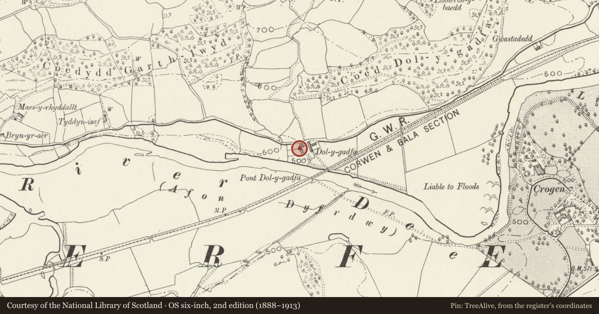
Slide toward Today to fade the historical sheet and see the modern map underneath.
David Rumsey Map Collection, Stanford LibrariesDavid Rumsey Map Collection, Stanford LibrariesLlyfrgell Genedlaethol Cymru – The National Library of WalesDavid Rumsey Map Collection, Stanford LibrariesDavid Rumsey Map Collection, Stanford Libraries
5 historical maps cover this location, the earliest the 1795 map "To Sir Watkin Williams-Wynn Bart ... the map of the six counties of North Wales is most humbly inscribed by his obedient humble servant" (Llyfrgell Genedlaethol Cymru – The National Library of Wales).
Historical maps covering this location
- 1795 · To Sir Watkin Williams-Wynn Bart ... the map of the six counties of North Wales is most… (Llyfrgell Genedlaethol Cymru – The National Library of Wales)
- 1830 · V.3:11-15:XV. Britisches Reich. A. Kon: England. b. Frstenthum Wales: Shire: 37-40 (David Rumsey Map Collection, Stanford Libraries)
- 1883 · Watershed map England, Wales 3. (David Rumsey Map Collection, Stanford Libraries)
- 1898 · 120 Corwen (Hills) (David Rumsey Map Collection, Stanford Libraries)
- 1901 · Sheet 9 and 10. (David Rumsey Map Collection, Stanford Libraries)
Cadw's description
Location
Located immediately to the SW of Dol-y-Gadfa, enclosing a forecourt on the W side.
History
Stone barn of mid or second-half C17 origin, built to serve the adjacent farmhouse. This was extended by 2 bays to the S in the early C19 to accommodate a pair of cart sheds with granary loft over.
Exterior
Stone agricultural range consisting of a primary barn section with a flush, continuously-roofed cart-house addition to the L. Of local rubble construction with corrugated asbestos roof. The main (E) side has an off-centre barn entrance with modern stable door and C20 brick infilling above; 2 slate steps up. Flanking this are square boarded loading bays under the eaves, with ventilators below. Two large cart entrances to the additional section, with central dividing pier and expressed timber lintels. Above these are two 2-light windows with mesh; upper entrance to the S gable.
Interior
The interior was not inspected at the time of survey.
Reason for designation
Listed for group value with Dol-y-Gadfa.
Nearby in the register
- Dol-y-GadfaDomesticunder 1 mi
- Agricultural Range to the E of Dol-y-GadfaAgriculture and Subsistenceunder 1 mi
- CrogenDomesticunder 1 mi
- Barn at Garth-gochAgriculture and Subsistenceunder 1 mi
Other entries of the same register within about three miles of this one, by straight line.