Cof Cymru: National Historic Assets of Wales · Wales
Garden Wall of Stoneycroft House (old Walled Garden at Shirenewton Hall)
Shirenewton, Monmouthshire, Wales
A Grade II listed building in Shirenewton, Chepstow, Monmouthshire, designated on 30 January 2001.
The record
- Designation
- Listed building, Grade II
- Broad class
- Domestic
- Date of designation
- 30 January 2001
- Locality
- Shirenewton
- Town
- Chepstow
- Community
- Shirenewton
- Unitary authority
- Monmouthshire
- Country
- Wales
- Coordinates
- 51.63792, -2.75467
- Cadw reference
- 24574
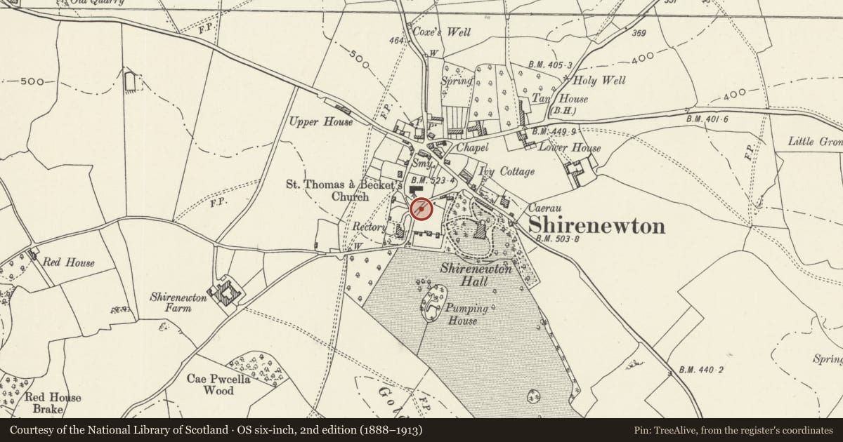
Slide toward Today to fade the historical sheet and see the modern map underneath.
David Rumsey Map Collection, Stanford LibrariesDavid Rumsey Map Collection, Stanford LibrariesDavid Rumsey Map Collection, Stanford LibrariesDavid Rumsey Map Collection, Stanford LibrariesDavid Rumsey Map Collection, Stanford Libraries
5 historical maps cover this location, the earliest the 1636 map "Cornubia : Devonia, Somersetus, Dorcestria, Wiltonia, Glocestria ..." (David Rumsey Map Collection, Stanford Libraries).
Historical maps covering this location
- 1636 · Cornubia : Devonia, Somersetus, Dorcestria, Wiltonia, Glocestria ... (David Rumsey Map Collection, Stanford Libraries)
- 1895 · Sheet 11. Ordnance Survey of England and Wales. (David Rumsey Map Collection, Stanford Libraries)
- 1897 · 250 Chepstow (Outline) (David Rumsey Map Collection, Stanford Libraries)
- 1905 · 250 Chepstow (Hills) (David Rumsey Map Collection, Stanford Libraries)
- 1913 · Sheet 102. Newport. (David Rumsey Map Collection, Stanford Libraries)
Cadw's description
Location
About 100m to the west of Shirenewton Hall and bordering the road towards Llanvair Discoed.
History
Probably c1830 when Shirenewton Hall was rebuilt by William Hollis, paper maker of Linnet Mill, Mounton and Sheriff of Monmouthshire in 1831. They are now partly the garden walls of Stoneycroft, a modern house, and partly still in the gardens of Shirenewton Hall.
Exterior
The walls are of limestone rubble on the outside faces with some brick facing on the inner side. They are 4-5m in height, the highest part being the south west corner on the Llanvair Discoed road opposite to Cae-pw-cella. They form a rectangle about 100m x 50m with the north west corner by the church rounded off.
Reason for designation
Included for its group value with Shirenewton Hall and the other listed items in the grounds as well as with the nearby Church of St Thomas a Becket and Cae-pw-cella.
Nearby in the register
- Church of St Thomas a BecketReligious, Ritual and Funeraryunder 1 mi
- Cae-pw-cella including attached milestoneTransportunder 1 mi
- Lodge to Shirenewton HallDomesticunder 1 mi
- Gates, Gatepiers, Railings and Walls at Shirenewton HallDomesticunder 1 mi
Other entries of the same register within about three miles of this one, by straight line.