Cof Cymru: National Historic Assets of Wales · Wales
War Memorial
Shirenewton, Monmouthshire, Wales
A Grade II listed building in Shirenewton, Chepstow, Monmouthshire, designated on 30 January 2001.
The record
- Designation
- Listed building, Grade II
- Broad class
- Commemorative
- Date of designation
- 30 January 2001
- Locality
- Shirenewton
- Town
- Chepstow
- Community
- Shirenewton
- Unitary authority
- Monmouthshire
- Country
- Wales
- Coordinates
- 51.63882, -2.75412
- Cadw reference
- 24573
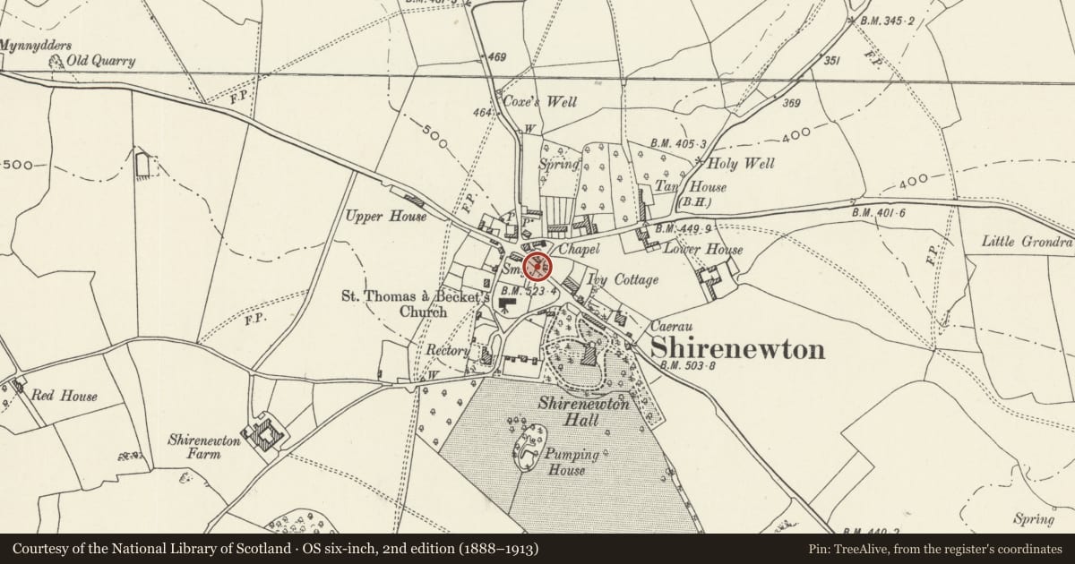
Slide toward Today to fade the historical sheet and see the modern map underneath.
David Rumsey Map Collection, Stanford LibrariesDavid Rumsey Map Collection, Stanford LibrariesDavid Rumsey Map Collection, Stanford LibrariesDavid Rumsey Map Collection, Stanford LibrariesDavid Rumsey Map Collection, Stanford Libraries
5 historical maps cover this location, the earliest the 1636 map "Cornubia : Devonia, Somersetus, Dorcestria, Wiltonia, Glocestria ..." (David Rumsey Map Collection, Stanford Libraries).
Historical maps covering this location
- 1636 · Cornubia : Devonia, Somersetus, Dorcestria, Wiltonia, Glocestria ... (David Rumsey Map Collection, Stanford Libraries)
- 1895 · Sheet 11. Ordnance Survey of England and Wales. (David Rumsey Map Collection, Stanford Libraries)
- 1897 · 250 Chepstow (Outline) (David Rumsey Map Collection, Stanford Libraries)
- 1905 · 250 Chepstow (Hills) (David Rumsey Map Collection, Stanford Libraries)
- 1913 · Sheet 102. Newport. (David Rumsey Map Collection, Stanford Libraries)
Cadw's description
Location
In the centre of Shirenewton village about 80m north east of the Church of St Thomas a Becket.
History
A memorial to the fallen of WWI erected in c1920.
Exterior
The memorial is constructed of granite ashlar with Portland stone plaques. It stands at the top of four wide stone steps and is in the form of a stone bench flanked by oak 'squeeze' stiles guarding the path to the church. The bench has arms, and a back which carries an incribed plaque, while another with flanking pilasters and an arched top stands above this. They are inscribed with the names of the fallen in WWI and WWII.
Reason for designation
Included for its historic interest as a village war memorial of unusual design.
Nearby in the register
- The Old RectoryDomesticunder 1 mi
- Newton LodgeDomesticunder 1 mi
- Gates, Gatepiers, Railings and Walls at Shirenewton HallDomesticunder 1 mi
- Church of St Thomas a BecketReligious, Ritual and Funeraryunder 1 mi
Other entries of the same register within about three miles of this one, by straight line.